Difference between revisions of "2008-06-01 51 5"
m (Replacing Peeron with Geohashing.info) |
m (fix, sorry) |
||
| Line 35: | Line 35: | ||
<gallery caption="Pictures" widths="267px" perrow="3"> | <gallery caption="Pictures" widths="267px" perrow="3"> | ||
Image:2008-06-01_51_5_cycling.jpg|Going past endless fields of farm at around 20kmh | Image:2008-06-01_51_5_cycling.jpg|Going past endless fields of farm at around 20kmh | ||
| − | Image:2008-06-01_51_5_fridayhash.jpg|The route brought me past the geohash of {{egl|2008-05-23|51 | + | Image:2008-06-01_51_5_fridayhash.jpg|The route brought me past the geohash of {{egl|2008-05-23|51|5|text=9 days}} ago by accident |
Image:2008-06-01_51_5_tennis.jpg|A ball came over a tennisfence, people searched for it | Image:2008-06-01_51_5_tennis.jpg|A ball came over a tennisfence, people searched for it | ||
Image:2008-06-01_51_5_routenetwork.jpg|Halfway there! | Image:2008-06-01_51_5_routenetwork.jpg|Halfway there! | ||
Latest revision as of 18:47, 18 January 2022
| Sun 1 Jun 2008 in Eindhoven: 51.3491079, 5.9162389 geohashing.info google osm bing/os kml crox |
Expedition made by Paul
I wasn't planning on going but saw that the location was within cycling range and decided to go biking to the location. Equiped with water, a map and a backlog of Security Now podcasts on my iPod (which kept rambling about Yubikey) I started the trip at about 14:00 from Geldrop
The hashpoint was in the middle of a farmfield near a line of trees. I ventured through an empty grassfield and got to within 15 meters of the hashpoint
Total Expedition Odometry: 62680m
- Pictures
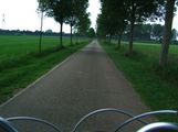
Going past endless fields of farm at around 20kmh
The route brought me past the geohash of 9 days ago by accident
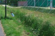
A ball came over a tennisfence, people searched for it
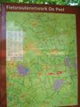
Halfway there!

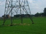
Some black sheep among white sheep
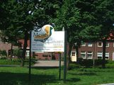
Being welcomed to Meijel, crossroads of 'de Peel'
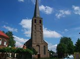
The church of Meijel, not exactly my taste
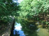
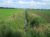
The line of trees on the map turned out to be lush vegetation along a canal
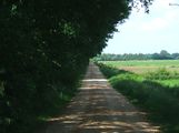
A convenient farmroad between the canal and the farmfields led me to the hashpoint
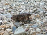
I saw a frog on the road, I tried to take a picture of it but it came out blurry
The ditch was in an uproar of noise as I arrived, ducks quacked and frogs croaked loudly
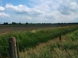
I walked along the ditch on the empty grassland but there was another ditch between me and my destination
Got there bang on time!
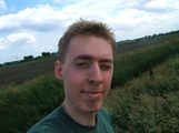
Paul standing proudly at his first geohash with the hashpoint about 15 meters behind me.


