Difference between revisions of "2022-02-05 39 -76"
From Geohashing
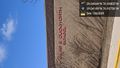
([live picture]So it turns out that this geohash is close enough that I don't even have to get out of my car to enjoy it! [https://openstreetmap.org/?lat=39.04047190&lon=-76.93799370&zoom=16&layers=B000FTF @39.0405,-76.9380]) |
m (Location) |
||
| (5 intermediate revisions by 2 users not shown) | |||
| Line 15: | Line 15: | ||
== Location == | == Location == | ||
<!-- where you've surveyed the hash to be --> | <!-- where you've surveyed the hash to be --> | ||
| + | This Geohash is located in the parking lot of an apartment complex next to a church in Beltsville. | ||
== Participants == | == Participants == | ||
<!-- who attended: If you link to your wiki user name in this section, your expedition will be picked up by the various statistics generated for geohashing. You may use three tildes ~ as a shortcut to automatically insert the user signature of the account you are editing with. | <!-- who attended: If you link to your wiki user name in this section, your expedition will be picked up by the various statistics generated for geohashing. You may use three tildes ~ as a shortcut to automatically insert the user signature of the account you are editing with. | ||
--> | --> | ||
| + | *[[User:OfficeLinebacker|OfficeLinebacker]] | ||
== Plans == | == Plans == | ||
| Line 28: | Line 30: | ||
*I'm going to give this one a try. It's next to a church called "Iglesia Pentecostes Jesucristo Es Mi Guia" which means Jesus Christ is my guide Pentecostal Church. -- [[User:OfficeLinebacker|OfficeLinebacker]] ([[User talk:OfficeLinebacker|talk]]) [https://openstreetmap.org/?lat=39.09308200&lon=-77.15541980&zoom=16&layers=B000FTF @39.0931,-77.1554] 11:22, 5 February 2022 (EST) | *I'm going to give this one a try. It's next to a church called "Iglesia Pentecostes Jesucristo Es Mi Guia" which means Jesus Christ is my guide Pentecostal Church. -- [[User:OfficeLinebacker|OfficeLinebacker]] ([[User talk:OfficeLinebacker|talk]]) [https://openstreetmap.org/?lat=39.09308200&lon=-77.15541980&zoom=16&layers=B000FTF @39.0931,-77.1554] 11:22, 5 February 2022 (EST) | ||
| + | |||
| + | *... which was nice because it's cold out today -- [[User:OfficeLinebacker|OfficeLinebacker]] ([[User talk:OfficeLinebacker|talk]]) [https://openstreetmap.org/?lat=39.04048280&lon=-76.93800580&zoom=16&layers=B000FTF @39.0405,-76.9380] 11:54, 5 February 2022 (EST) | ||
| + | |||
| + | *the location was in the parking lot of an apartment complex, so presumably the prevent the costal churches something that's run out of somebody's apartment and I wasn't going to knock on doors. -- [[User:OfficeLinebacker|OfficeLinebacker]] ([[User talk:OfficeLinebacker|talk]]) [https://openstreetmap.org/?lat=39.04188430&lon=-76.93755790&zoom=16&layers=B000FTF @39.0419,-76.9376] 11:56, 5 February 2022 (EST) | ||
| + | |||
| + | *The school has a student to teach at ratio of five to one, and is named after a famous educator who dedicated his life to improving schools in Prince George's county Maryland, where we are today. https://schools.pgcps.org/James-E-Duckworth/About-James-E-Duckworth/ -- [[User:OfficeLinebacker|OfficeLinebacker]] ([[User talk:OfficeLinebacker|talk]]) [https://openstreetmap.org/?lat=39.04190890&lon=-76.93755200&zoom=16&layers=B000FTF @39.0419,-76.9376] 11:59, 5 February 2022 (EST) | ||
== Tracklog == | == Tracklog == | ||
<!-- if your GPS device keeps a log, you may use Template:Tracklog, post a link here, or both --> | <!-- if your GPS device keeps a log, you may use Template:Tracklog, post a link here, or both --> | ||
| Line 38: | Line 46: | ||
Image:2022-02-05_39_-76_OfficeLinebacker_1644080064471.jpg|So it turns out that this geohash is close enough that I don't even have to get out of my car to enjoy it! [https://openstreetmap.org/?lat=39.04047190&lon=-76.93799370&zoom=16&layers=B000FTF @39.0405,-76.9380] | Image:2022-02-05_39_-76_OfficeLinebacker_1644080064471.jpg|So it turns out that this geohash is close enough that I don't even have to get out of my car to enjoy it! [https://openstreetmap.org/?lat=39.04047190&lon=-76.93799370&zoom=16&layers=B000FTF @39.0405,-76.9380] | ||
| + | |||
| + | Image:2022-02-05_39_-76_OfficeLinebacker_1644080233425.jpg|I didn't notice on the map during the reconnaissance phase, but right nearby is the James e duckworth School. [https://openstreetmap.org/?lat=39.04188610&lon=-76.93755890&zoom=16&layers=B000FTF @39.0419,-76.9376] | ||
</gallery> | </gallery> | ||
| Line 44: | Line 54: | ||
<!-- Add any achievement ribbons you earned below, or remove this section --> | <!-- Add any achievement ribbons you earned below, or remove this section --> | ||
| − | |||
| − | |||
| − | |||
| − | |||
| − | |||
| − | |||
| − | |||
| − | |||
| − | |||
| − | |||
| − | |||
| − | |||
| − | |||
| − | |||
[[Category:Expeditions]] | [[Category:Expeditions]] | ||
| − | |||
[[Category:Expeditions with photos]] | [[Category:Expeditions with photos]] | ||
| − | |||
| − | |||
| − | |||
| − | |||
| − | |||
[[Category:Coordinates reached]] | [[Category:Coordinates reached]] | ||
| − | + | {{location|US|MD|PR}} | |
| − | |||
| − | |||
| − | |||
| − | |||
| − | |||
| − | |||
| − | |||
| − | |||
| − | |||
| − | |||
| − | |||
| − | |||
| − | |||
| − | |||
| − | |||
| − | |||
| − | |||
Latest revision as of 17:42, 6 February 2022
| Sat 5 Feb 2022 in 39,-76: 39.0404422, -76.9380507 geohashing.info google osm bing/os kml crox |
Location
This Geohash is located in the parking lot of an apartment complex next to a church in Beltsville.
Participants
Plans
Expedition
- I'm going to give this one a try. It's next to a church called "Iglesia Pentecostes Jesucristo Es Mi Guia" which means Jesus Christ is my guide Pentecostal Church. -- OfficeLinebacker (talk) @39.0931,-77.1554 11:22, 5 February 2022 (EST)
- ... which was nice because it's cold out today -- OfficeLinebacker (talk) @39.0405,-76.9380 11:54, 5 February 2022 (EST)
- the location was in the parking lot of an apartment complex, so presumably the prevent the costal churches something that's run out of somebody's apartment and I wasn't going to knock on doors. -- OfficeLinebacker (talk) @39.0419,-76.9376 11:56, 5 February 2022 (EST)
- The school has a student to teach at ratio of five to one, and is named after a famous educator who dedicated his life to improving schools in Prince George's county Maryland, where we are today. https://schools.pgcps.org/James-E-Duckworth/About-James-E-Duckworth/ -- OfficeLinebacker (talk) @39.0419,-76.9376 11:59, 5 February 2022 (EST)
Tracklog
Photos

So it turns out that this geohash is close enough that I don't even have to get out of my car to enjoy it! @39.0405,-76.9380
I didn't notice on the map during the reconnaissance phase, but right nearby is the James e duckworth School. @39.0419,-76.9376

