Difference between revisions of "2022-02-13 43 1"
From Geohashing
PulkoMandy (talk | contribs) (Created page with "{{subst:Expedition |lat = 43 |lon = 1 |date = 2022-02-13 }} == Participants == User:PulkoMandy == Plans == I was out of things to visit in my local area for my w...") |
m (Location) |
||
| (2 intermediate revisions by 2 users not shown) | |||
| Line 1: | Line 1: | ||
| − | + | {{meetup graticule | |
| − | |||
| − | |||
| − | |||
| − | |||
| − | |||
| − | |||
| − | |||
| − | |||
| lat=43 | | lat=43 | ||
| lon=1 | | lon=1 | ||
| Line 14: | Line 6: | ||
__NOTOC__ | __NOTOC__ | ||
== Location == | == Location == | ||
| − | + | The point is near the Canal des Deux Mers. | |
== Participants == | == Participants == | ||
| − | + | *[[User:PulkoMandy|PulkoMandy]] | |
| − | |||
== Plans == | == Plans == | ||
| − | + | I was out of things to visit in my local area for my weekend bike trips. So I finally decided to try Geohashing. | |
== Expedition == | == Expedition == | ||
| − | + | The point is near the Canal des Deux Mers, which means straight bicycle path all the way from my home. And I had tailwind which made it quite easy and fast too. | |
| − | + | Exiting the Canal, I crossed a sand extraction area (staying safely on the road) and then reached the point which was in the middle of a field with nothing very exciting to see. | |
| − | + | ||
| + | I went back to the Canal and used it to reach the nearest train station, and got home by train. | ||
| − | == Photos == | + | == Photos == |
| − | < | + | <gallery mode=packed heights=200px> |
| − | + | File:20220213-43-1-proof.png|GPS screenshot at the point | |
| − | -- | + | File:20220213-43-1-point1.jpg|View to the south |
| − | + | File:20220213-43-1-point2.jpg|View to the north | |
</gallery> | </gallery> | ||
| − | |||
| − | |||
| − | |||
| − | |||
| − | |||
| − | |||
| − | |||
| − | |||
| − | |||
| − | |||
| − | |||
| − | |||
| − | |||
| − | |||
| − | |||
| − | |||
| − | |||
| − | |||
[[Category:Expeditions]] | [[Category:Expeditions]] | ||
| − | |||
[[Category:Expeditions with photos]] | [[Category:Expeditions with photos]] | ||
| − | |||
| − | |||
| − | |||
| − | |||
| − | |||
[[Category:Coordinates reached]] | [[Category:Coordinates reached]] | ||
| − | + | {{location|FR|31}} | |
| − | |||
| − | |||
| − | |||
| − | |||
| − | |||
| − | |||
| − | |||
| − | |||
| − | |||
| − | |||
| − | |||
| − | |||
| − | |||
| − | |||
| − | |||
| − | |||
| − | |||
| − | |||
| − | |||
| − | |||
| − | |||
| − | |||
| − | |||
| − | |||
| − | |||
| − | |||
| − | |||
| − | |||
| − | |||
| − | |||
| − | |||
| − | |||
| − | |||
| − | |||
| − | |||
| − | |||
| − | |||
| − | |||
Latest revision as of 21:42, 19 February 2022
| Sun 13 Feb 2022 in 43,1: 43.7869336, 1.3075959 geohashing.info google osm bing/os kml crox |
Location
The point is near the Canal des Deux Mers.
Participants
Plans
I was out of things to visit in my local area for my weekend bike trips. So I finally decided to try Geohashing.
Expedition
The point is near the Canal des Deux Mers, which means straight bicycle path all the way from my home. And I had tailwind which made it quite easy and fast too.
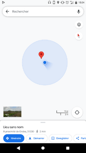
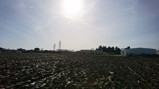
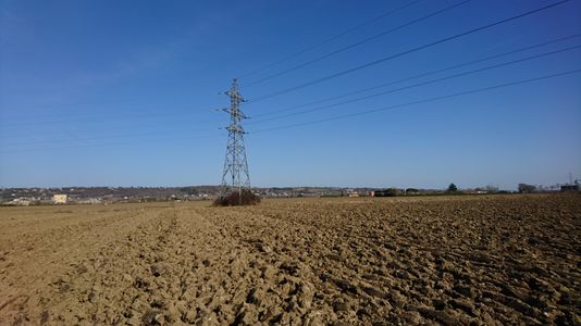
Exiting the Canal, I crossed a sand extraction area (staying safely on the road) and then reached the point which was in the middle of a field with nothing very exciting to see.
I went back to the Canal and used it to reach the nearest train station, and got home by train.


