Difference between revisions of "2022-02-27 42 -72"
From Geohashing
Cibachrome (talk | contribs) (Created page with "{{subst:Expedition |lat = 42 |lon = -72 |date = 2022-02-27 }}") |
m (Location) |
||
| (14 intermediate revisions by 2 users not shown) | |||
| Line 14: | Line 14: | ||
__NOTOC__ | __NOTOC__ | ||
== Location == | == Location == | ||
| − | + | Along Grimes Rd., a small road on the outskirts of Keene, New Hampshire | |
== Participants == | == Participants == | ||
<!-- who attended: If you link to your wiki user name in this section, your expedition will be picked up by the various statistics generated for geohashing. You may use three tildes ~ as a shortcut to automatically insert the user signature of the account you are editing with. | <!-- who attended: If you link to your wiki user name in this section, your expedition will be picked up by the various statistics generated for geohashing. You may use three tildes ~ as a shortcut to automatically insert the user signature of the account you are editing with. | ||
--> | --> | ||
| + | [[User:Cibachrome|Cibachrome]] | ||
| + | <br>Cibachrome's Dad | ||
== Plans == | == Plans == | ||
<!-- what were the original plans --> | <!-- what were the original plans --> | ||
| + | I was already headed out that way today with my dad, so the plan was to bother him to drive to the hashpoint (easily accessible, on a road near where we were for once!). | ||
== Expedition == | == Expedition == | ||
<!-- how it all turned out. your narrative goes here. --> | <!-- how it all turned out. your narrative goes here. --> | ||
| + | After tending to some errands etc, we found our way to Grimes Rd. There was some concern that it would be a private road, or that we would otherwise not be able to reach the point, but everything went great. I stepped out of the car, walked to the point, which was in fact right on the road, waved my phone in the air until I got a good reading, walked along the road for a bit just to account for any error in the GPS reading, then got back in the car and left. | ||
| − | == Tracklog == | + | <!-- == Tracklog == --> |
<!-- if your GPS device keeps a log, you may use Template:Tracklog, post a link here, or both --> | <!-- if your GPS device keeps a log, you may use Template:Tracklog, post a link here, or both --> | ||
== Photos == | == Photos == | ||
<!-- Insert pictures between the gallery tags using the following format: | <!-- Insert pictures between the gallery tags using the following format: | ||
| − | + | ||
--> | --> | ||
<gallery perrow="5"> | <gallery perrow="5"> | ||
| + | Image:2022-02-27_42_-72_Cibachrome_1.png | Google Maps screenshot! | ||
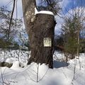
| + | Image:2022-02-27_42_-72_Cibachrome_2.png | One of the comically many posted signs along this road. If the hashpoint were further from the road I would have had to abandon | ||
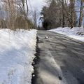
| + | Image:2022-02-27_42_-72_Cibachrome_3.png | A view of the scenery visible from 2022-02-27 42 -72 | ||
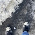
| + | Image:2022-02-27_42_-72_Cibachrome_4.png | it me | ||
</gallery> | </gallery> | ||
| Line 40: | Line 48: | ||
<!-- Add any achievement ribbons you earned below, or remove this section --> | <!-- Add any achievement ribbons you earned below, or remove this section --> | ||
| − | + | {{land geohash | latitude = 42 | longitude = -72 | date = 2022-02-27 | name = Cibachrome }} | |
| − | + | ||
| − | |||
| − | |||
| − | |||
| − | |||
| − | |||
| − | |||
| − | |||
| − | |||
| − | |||
| − | |||
| − | |||
| − | |||
[[Category:Expeditions]] | [[Category:Expeditions]] | ||
| − | |||
[[Category:Expeditions with photos]] | [[Category:Expeditions with photos]] | ||
| − | |||
| − | |||
| − | |||
| − | |||
| − | |||
[[Category:Coordinates reached]] | [[Category:Coordinates reached]] | ||
| − | + | {{location|US|NH|CH}} | |
| − | |||
| − | |||
| − | |||
| − | |||
| − | |||
| − | |||
| − | |||
| − | |||
| − | |||
| − | |||
| − | |||
| − | |||
| − | |||
| − | |||
| − | |||
| − | |||
| − | |||
Latest revision as of 13:42, 1 March 2022
| Sun 27 Feb 2022 in 42,-72: 42.9300790, -72.3497674 geohashing.info google osm bing/os kml crox |
Location
Along Grimes Rd., a small road on the outskirts of Keene, New Hampshire
Participants
Cibachrome
Cibachrome's Dad
Plans
I was already headed out that way today with my dad, so the plan was to bother him to drive to the hashpoint (easily accessible, on a road near where we were for once!).
Expedition
After tending to some errands etc, we found our way to Grimes Rd. There was some concern that it would be a private road, or that we would otherwise not be able to reach the point, but everything went great. I stepped out of the car, walked to the point, which was in fact right on the road, waved my phone in the air until I got a good reading, walked along the road for a bit just to account for any error in the GPS reading, then got back in the car and left.
Photos
Achievements
Cibachrome earned the Land geohash achievement
|


