Difference between revisions of "2022-10-23 47 7"
(Create page) |
m (Location) |
||
| Line 43: | Line 43: | ||
[[Category:Coordinates reached]] | [[Category:Coordinates reached]] | ||
[[Category:Expeditions with photos]] | [[Category:Expeditions with photos]] | ||
| + | {{location|FR|68}} | ||
Latest revision as of 22:42, 27 March 2023
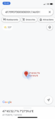
| Sun 23 Oct 2022 in 47,7: 47.7590737, 7.4610147 geohashing.info google osm bing/os kml crox |
Location
In the Hardt forest, near Hombourg.
Participants
Expedition
I took train to Mulhouse, then cycled along the Rhône-Rhine Canal toward Basel. After 10 kilometers, I left my bicycle attached to a tree by the side of the cycle path, entered the Hardt forest and walked 200m to the geohash.
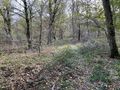
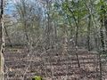
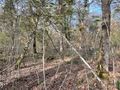
The coordinates were located somewhere between a couple of nondescript trees. After recording proof, I cycled to Hombourg to see whether there was anything worth noting. Apparently, someone decided to build a farm disguised as fake medieval castle during the 1920s. They also have a genuine non-medieval castle that serves as a restaurant, and a golf course, but I didn't see those.
I returned on the cycle path and cycled to Saint-Louis to take a train back home.
Photos
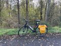
My bicycle near the coordinates
Walking to the coordinates
Coordinates reached
Surroundings (South-East)
Surroundings (North)
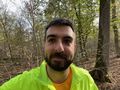
Stupid grin
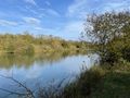
Along the canal
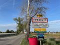
In Hombourg
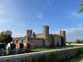
A castle, with a triple garage


Achievements
Baarde earned the Land geohash achievement
|