Difference between revisions of "2023-05-01 58 5"
From Geohashing
(→Location) |
(→Expedition) |
||
| (One intermediate revision by the same user not shown) | |||
| Line 30: | Line 30: | ||
<!-- how it all turned out. your narrative goes here. --> | <!-- how it all turned out. your narrative goes here. --> | ||
| − | I had to wait until the afternoon before the rain stopped and the weather became suitable for a trip. On the way to the day's geohash, I found a small viper on the side of the road. Afterwards I went slightly the wrong way so I had to climb up a rock pile. The walk was only about 2 km from where I parked. | + | I had to wait until the afternoon before the rain stopped and the weather became suitable for a trip. On the way to the day's geohash, I found a small viper on the side of the road. Afterwards I went slightly the wrong way so I had to climb up a rock pile. The walk was only about 2 km round trip from where I parked. |
== Tracklog == | == Tracklog == | ||
Latest revision as of 16:28, 1 May 2023
| Mon 1 May 2023 in 58,5: 58.6960156, 5.7992520 geohashing.info google osm bing/os kml crox |
Location
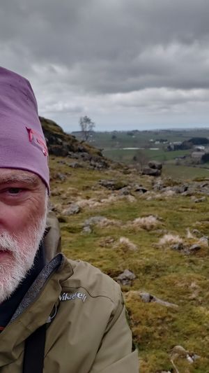
On a mountain pasture near Litla-Undheim, Time, Norway
Participants
Plans
Expedition
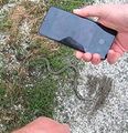
I had to wait until the afternoon before the rain stopped and the weather became suitable for a trip. On the way to the day's geohash, I found a small viper on the side of the road. Afterwards I went slightly the wrong way so I had to climb up a rock pile. The walk was only about 2 km round trip from where I parked.
Tracklog
Photos
Achievements
Pica42 earned the Land geohash achievement
|


