Difference between revisions of "2023-06-14 50 11"
From Geohashing
(Source: https://www.strava.com/activities/9266488516) |
m (Location) |
||
| Line 25: | Line 25: | ||
[[Category:Expeditions with photos]] | [[Category:Expeditions with photos]] | ||
[[Category:Pages in German]] | [[Category:Pages in German]] | ||
| + | {{location|DE|TH|SHK}} | ||
Latest revision as of 17:43, 18 July 2023
| Wed 14 Jun 2023 in 50,11: 50.8540369, 11.7577955 geohashing.info google osm bing/os kml crox |
Location
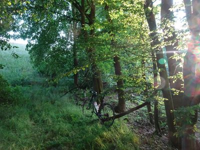
This Geohash is located in a forest between Quirla and Ulrichswalde.
Participants
Expedition
- Geohash nicht ganz erreicht, aber mal ne andere Richtung
- Exakt bei 50.85404, 11.75780 - zwischen Quirla und Ulrichswalde. Aber ein bewaldeter Hang und an anderer Stelle ein Weidezaun (sowie meine Faulheit) verhinderten, dass ich näher als ca. 80 m herankam. (übrigens nicht zu verwechseln mit einem Geocache!)
Photos
Tracklog
