Difference between revisions of "2023-10-14 41 -117"
m (Location) |
m (subst-ing) |
||
| (2 intermediate revisions by 2 users not shown) | |||
| Line 8: | Line 8: | ||
And DON'T FORGET to add your expedition and the best photo you took to the gallery on the Main Page! We'd love to read your report, but that means we first have to discover it! :) | And DON'T FORGET to add your expedition and the best photo you took to the gallery on the Main Page! We'd love to read your report, but that means we first have to discover it! :) | ||
-->{{meetup graticule | -->{{meetup graticule | ||
| − | | lat= | + | | lat=41 |
| − | | lon= | + | | lon=-117 |
| − | | date= | + | | date=2023-10-14 |
}}<!-- edit as necessary --> | }}<!-- edit as necessary --> | ||
== Location == | == Location == | ||
| Line 38: | Line 38: | ||
== Achievements == | == Achievements == | ||
{{#vardefine:ribbonwidth|100%}} | {{#vardefine:ribbonwidth|100%}} | ||
| − | {{ | + | {{Graticule unlocked |
| latitude = 41 | | latitude = 41 | ||
| Line 46: | Line 46: | ||
}} | }} | ||
| − | + | ||
| + | |||
| + | {{Minesweeper geohash | ||
| + | | graticule = [[Jordan Valley, Oregon]] | ||
| + | | ranknumber = 5 | ||
| + | | n = true | ||
| + | | ne = true if graticule to the northeast has been hashed (optional) | ||
| + | | s = true if graticule to the south has been hashed (optional) | ||
| + | | nw = true if graticule to the northwest has been hashed (optional) | ||
| + | | name = [[User:Michael5000|Michael5000]] | ||
| + | }} | ||
| + | {{Minesweeper geohash | ||
| + | | graticule = [[Fields, Oregon]] | ||
| + | | ranknumber = 5 | ||
| + | | n = true | ||
| + | | ne = true if graticule to the northeast has been hashed (optional) | ||
| + | | se = true if graticule to the southeast has been hashed (optional) | ||
| + | | nw = true if graticule to the northwest has been hashed (optional) | ||
| + | | name = [[User:Michael5000|Michael5000]] | ||
| + | }} | ||
__NOTOC__ | __NOTOC__ | ||
Latest revision as of 21:08, 24 May 2024
| Sat 14 Oct 2023 in 41,-117: 41.5873906, -117.9453599 geohashing.info google osm bing/os kml crox |
Location
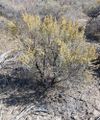
In sagebrush off Nevada 293, west of Orovado.
Participants
Expedition
I hadn't thought too hard about what to do after the eclipse, so after 2023-10-14 40 -116 I stopped in Winnemucca to plan the rest of the day. The little shop I randomly picked out turned out to be a new-agey tea and smoothie joint -- no coffee! -- with a lot of "natural healing" rhetoric going on; given Winnemucca's bikers-'n'-casinos reputation, I was pretty darn charmed.
Refreshed by my naturally-healing tea and smoothy, and having refueled and found coffee at a truckstop 20 miles north of town, I proceeded to tiny Orovada, continued 7 miles west, and took another short hike in sagebrush to the hashpoint. More great scenery, and another graticule pioneered for geohashing!
I trusted the Nevada State Highway Map, fool that I am, that the gravel road would be a short cut back south to Nevada 140, but it got smaller and smaller and then effectively dead-ended in a rancher's front yard. Something resembling a road continued south, but even with the Expedition Vehicle, it wasn't a road I was willing to travel. So, there was a lot of backtracking. But then, I was geohashing! Backtracking is kind of baked into the enterprise.
Photos
Achievements
Michael5000 earned the Graticule Unlocked Achievement
|
Michael5000 achieved level 5 of the Minesweeper Geohash achievement
|
Michael5000 achieved level 5 of the Minesweeper Geohash achievement
|


