Difference between revisions of "2023-11-14 -35 140"
(Created page with "{{subst:Expedition}}") |
m (subst-ing) |
||
| (7 intermediate revisions by 4 users not shown) | |||
| Line 8: | Line 8: | ||
And DON'T FORGET to add your expedition and the best photo you took to the gallery on the Main Page! We'd love to read your report, but that means we first have to discover it! :) | And DON'T FORGET to add your expedition and the best photo you took to the gallery on the Main Page! We'd love to read your report, but that means we first have to discover it! :) | ||
-->{{meetup graticule | -->{{meetup graticule | ||
| − | | lat= | + | | lat=-35 |
| − | | lon= | + | | lon=140 |
| − | | date= | + | | date=2023-11-14 |
}}<!-- edit as necessary --> | }}<!-- edit as necessary --> | ||
== Location == | == Location == | ||
<!-- where you've surveyed the hash to be --> | <!-- where you've surveyed the hash to be --> | ||
| + | A field just north of Coombe, South Australia | ||
== Participants == | == Participants == | ||
| − | + | * [[User:Pwc|Pwc]] ([[User talk:Pwc|talk]]) | |
| − | + | * Pwc's boss | |
| + | * Pwc's co-worker (stayed in the car) | ||
== Plans == | == Plans == | ||
| − | + | I had a work conference in Adelaide so needed to get there from Melbourne. Myself, my boss and a coworker decided to drive. I sneakily reviewed the hashpoints in each graticule we were passing through and identified this as the most practical. Still... to convince others to make a detour during a six hour drive requires a degree of subtlety and cunning. | |
== Expedition == | == Expedition == | ||
| − | + | Myself, my boss and a co-worker met in Ballarat to drive to Adelaide. The hashpoint I was thinking of was several hundred kilometres away, and neither of my colleagues had previously been introduced to geohashing. Therefore I planned my pitch carefully: I waited until we were 15 minutes away, told them about geohashing, and appealed to their FOMO. They are used to me saying weird and/or lunatic things and therefore agreed to undertake at least reconnaissance of the area. | |
| + | |||
| + | [[File:2023-11-14_35s140e_train.jpg|thumb|A rogue freight train cuts off our initial approach to the hashpoint]] | ||
| + | |||
| + | Obviously at this point my phone GPS stopped working, so I had to dust off my map-reading skills to figure out where to make the turnoff. We turned off the road in the right place, and then had to cross train tracks. The rail line, which we could see from the road and which had been empty for the preceding four hours, immediately produced a long freight train that took some time to pass. This did not endear my colleagues to the concept. | ||
| + | |||
| + | We then drove along towards the closest on-road point to the hash. On the way we saw a very promising-looking opening in the fence, about 800 metres from the hashpoint, which would lend a patina of credibility to the idea public access was permitted to the field. My co-worker decided to guard the car (so, as my phone’s GPS was unreliable, I confiscated his phone [a] for hash-locating purposes, and [b] to discourage him from driving away without us), while my boss and I set off towards the hashpoint. We got about twenty metres before realising the field we were in had some sort of grain, possibly wheat. It seemed undesirable to damage crops—even in the service of geohashing—so we retreated for another approach, continuing along the road until the absolute closest point. | ||
| + | |||
| + | This turned out to be at the fence between two fields. One was the wheatfield; while the other (which contained the hashpoint) was guarded by cows. I declared further progress impossible, that the cows were dangerous and that our only option was to declare failure and turn around. My boss however assured me that it was safe and that it would be nothing like “the time [my boss] had to run through a field being chased by a bull and ran into an electric fence”. I hadn’t even thought of electric fences and this new danger, along with snakes, was added to my fears. | ||
| + | |||
| + | [[File:2023-11-14_35s140e_shoe.jpg|thumb|My shoe after the geohashing and some attempts to clean it]] | ||
| − | + | As a compromise, I entered the wheat field and walked along the fence, while my boss walked in the cow field. While neither field was designed to be walked through, the wheat field was considerably worse and was only barely compatible with my shoes. The cows, by contrast, were docile and headed away as we approached. The wheat field was also unfortunate because I then had to cross another fence to get into the cow field and head to the hashpoint. The fence was an electric fence. Thankfully empirical testing determined it was not energised. | |
| − | + | ||
| + | [[File:2023-11-1435s140e_hashpoint.jpg|thumb|Me and my boss at the hashpoint]] | ||
| + | |||
| + | After locating the safest and easiest crossing point, we managed to both be in the same field, and were only a couple of hundred metres from the hashpoint. The final approach was uneventful, except that it started raining and we had to dodge a lot of cow dung. We made it to the point, although unfortunately had not brought celebratory beers. | ||
| + | |||
| + | [[File:2023-11-14_35s140e_cows.jpg|thumb|Our new cow friends]] | ||
| + | |||
| + | We then returned the way we came, saying hi to the cows on the way back. They looked at us balefully. | ||
| + | |||
| + | I still have a job. It is unclear whether my boss will take up the sport. | ||
== Photos == | == Photos == | ||
| Line 33: | Line 54: | ||
--> | --> | ||
<gallery perrow="5"> | <gallery perrow="5"> | ||
| + | File:2023-11-14_35s140e_grin.jpg | Hash achieved | ||
| + | File:2023-11-1435s140e_proof.png | Proof | ||
| + | File:2023-11-14_35s140e_lameroo.jpg | Roadsign pointing to the graticule’s namesake, Lameroo | ||
</gallery> | </gallery> | ||
== Achievements == | == Achievements == | ||
{{#vardefine:ribbonwidth|100%}} | {{#vardefine:ribbonwidth|100%}} | ||
| − | + | {{Graticule unlocked | |
| − | + | | latitude = -35 | |
| − | + | | longitude = 140 | |
| − | + | | date = 2023-11-14 | |
| − | + | | name = Pwc (Patrick) | |
| + | | image = 2023-11-14 35s140e grin.jpg | ||
| − | + | }} | |
| − | + | {{land geohash | |
| − | + | | latitude = -35 | |
| − | [[ | + | | longitude = 140 |
| − | + | | date = 2023-11-14 | |
| + | | name = [[User:pwc]] and his boss | ||
| + | }} | ||
| − | + | {{drag-along | |
| + | | latitude = -35 | ||
| + | | longitude = 140 | ||
| + | | date = 2023-11-14 | ||
| + | | partner = Pwc's boss | ||
| + | | name = [[User:Pwc]] | ||
| + | }} | ||
| + | __NOTOC__ | ||
| − | |||
[[Category:Expeditions]] | [[Category:Expeditions]] | ||
| − | |||
[[Category:Expeditions with photos]] | [[Category:Expeditions with photos]] | ||
| − | |||
| − | |||
| − | |||
| − | |||
| − | |||
[[Category:Coordinates reached]] | [[Category:Coordinates reached]] | ||
| − | + | {{location|AU|SA|CO}} | |
| − | |||
| − | |||
| − | |||
| − | |||
| − | |||
| − | |||
| − | |||
| − | |||
| − | |||
| − | |||
| − | |||
| − | |||
| − | |||
| − | |||
| − | |||
| − | |||
| − | |||
Latest revision as of 21:09, 24 May 2024
| Tue 14 Nov 2023 in -35,140: -35.9312338, 140.1910897 geohashing.info google osm bing/os kml crox |
Location
A field just north of Coombe, South Australia
Participants
Plans
I had a work conference in Adelaide so needed to get there from Melbourne. Myself, my boss and a coworker decided to drive. I sneakily reviewed the hashpoints in each graticule we were passing through and identified this as the most practical. Still... to convince others to make a detour during a six hour drive requires a degree of subtlety and cunning.
Expedition
Myself, my boss and a co-worker met in Ballarat to drive to Adelaide. The hashpoint I was thinking of was several hundred kilometres away, and neither of my colleagues had previously been introduced to geohashing. Therefore I planned my pitch carefully: I waited until we were 15 minutes away, told them about geohashing, and appealed to their FOMO. They are used to me saying weird and/or lunatic things and therefore agreed to undertake at least reconnaissance of the area.
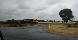
Obviously at this point my phone GPS stopped working, so I had to dust off my map-reading skills to figure out where to make the turnoff. We turned off the road in the right place, and then had to cross train tracks. The rail line, which we could see from the road and which had been empty for the preceding four hours, immediately produced a long freight train that took some time to pass. This did not endear my colleagues to the concept.
We then drove along towards the closest on-road point to the hash. On the way we saw a very promising-looking opening in the fence, about 800 metres from the hashpoint, which would lend a patina of credibility to the idea public access was permitted to the field. My co-worker decided to guard the car (so, as my phone’s GPS was unreliable, I confiscated his phone [a] for hash-locating purposes, and [b] to discourage him from driving away without us), while my boss and I set off towards the hashpoint. We got about twenty metres before realising the field we were in had some sort of grain, possibly wheat. It seemed undesirable to damage crops—even in the service of geohashing—so we retreated for another approach, continuing along the road until the absolute closest point.
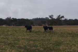
This turned out to be at the fence between two fields. One was the wheatfield; while the other (which contained the hashpoint) was guarded by cows. I declared further progress impossible, that the cows were dangerous and that our only option was to declare failure and turn around. My boss however assured me that it was safe and that it would be nothing like “the time [my boss] had to run through a field being chased by a bull and ran into an electric fence”. I hadn’t even thought of electric fences and this new danger, along with snakes, was added to my fears.
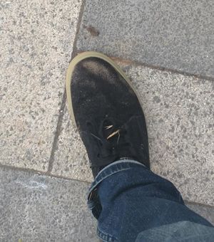
As a compromise, I entered the wheat field and walked along the fence, while my boss walked in the cow field. While neither field was designed to be walked through, the wheat field was considerably worse and was only barely compatible with my shoes. The cows, by contrast, were docile and headed away as we approached. The wheat field was also unfortunate because I then had to cross another fence to get into the cow field and head to the hashpoint. The fence was an electric fence. Thankfully empirical testing determined it was not energised.
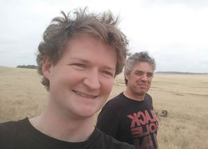
After locating the safest and easiest crossing point, we managed to both be in the same field, and were only a couple of hundred metres from the hashpoint. The final approach was uneventful, except that it started raining and we had to dodge a lot of cow dung. We made it to the point, although unfortunately had not brought celebratory beers.
We then returned the way we came, saying hi to the cows on the way back. They looked at us balefully.
I still have a job. It is unclear whether my boss will take up the sport.
Photos
Achievements
Pwc (Patrick) earned the Graticule Unlocked Achievement
|
User:pwc and his boss earned the Land geohash achievement
|
User:Pwc earned the Drag-along achievement
|


