Difference between revisions of "2024-04-28 52 8"
From Geohashing
(photos, tracklog) |
(last man standing) |
||
| (One intermediate revision by the same user not shown) | |||
| Line 29: | Line 29: | ||
{{#vardefine:ribbonwidth|100%}} | {{#vardefine:ribbonwidth|100%}} | ||
{{land geohash|date=2024-04-28|latitude=52|longitude=8|name=[[User:Fippe|Fippe]]|image=2024-04-28 52 8 03 Geohash.jpg}} | {{land geohash|date=2024-04-28|latitude=52|longitude=8|name=[[User:Fippe|Fippe]]|image=2024-04-28 52 8 03 Geohash.jpg}} | ||
| + | {{regional geohashing|region=[[User:Fippe/Progress#Wallenhorst|Wallenhorst]]|count=2|name=[[User:Fippe|Fippe]]|image=Wallenhorst regional.svg}} | ||
| + | {{last man standing|date=2024-04-28|latitude=52|longitude=8|name=[[User:Fippe|Fippe]]}} | ||
__NOTOC__ | __NOTOC__ | ||
Latest revision as of 21:30, 6 June 2024
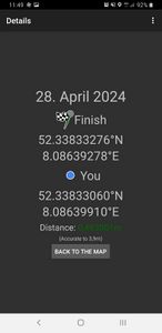
| Sun 28 Apr 2024 in 52,8: 52.3383328, 8.0863928 geohashing.info google osm bing/os kml crox |
Location
This Geohash is located on a field behind some houses in Rulle-Ost.
Participants
Expedition
In the late morning, I took the bus to Rulle/Stadtweg and walked the rest of the distance.
The coordinates were on a field behind some houses, I did not have trouble locating them and recording proof.
Afterwards, I walked back to Osnabrück.
Photos
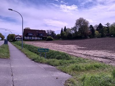
The site of the Geohash
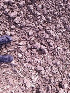
Proof
The Geohash
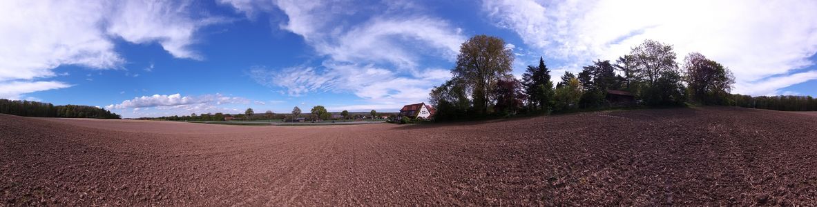
Surroundings


Tracklog
Ribbons
Fippe earned the Land geohash achievement
|
Fippe earned the Regional geohashing achievement
|
Fippe earned the Last man standing achievement
|