Difference between revisions of "2024-08-04 51 5"
MyrtleGlacy (talk | contribs) (Created page with "{{meetup graticule|date=2024-8-04|lat=51|lon=5}} == Location == Interesting hash on a forest road near Arnhem == Expedition 1 == Planning to be there in the middle of the da...") |
MyrtleGlacy (talk | contribs) |
||
| (6 intermediate revisions by 3 users not shown) | |||
| Line 3: | Line 3: | ||
== Location == | == Location == | ||
Interesting hash on a forest road near Arnhem | Interesting hash on a forest road near Arnhem | ||
| + | |||
| + | == Participants == | ||
| + | *[[User:MyrtleGlacy|MyrtleGlacy]] | ||
== Expedition 1 == | == Expedition 1 == | ||
| − | + | Looking at the hashes for the weekend, I saw this pretty little hash in a forest near Arnhem. Perfect for an expedition and a long walk afterwards. | |
| + | |||
| + | I got on the train in Tilburg with my girlfriend and had a direct connection to Arnhem. My girlfriend had other things to do beside hashing. I know, weird right. So she left the train at Oss. I exited at Arnhem and after a short drink and muesli bar break, went on my way. | ||
| + | The first bit had a slight incline. Nothing major, the biggest height difference between start and finish would 80m. But for the Netherlands, that almost like climbing up Everest. | ||
| + | |||
| + | Anyways, it was quite a pleasant walk to the hash. After leaving Arnhem, it was a forested area with some fields in between. Along my path, there were many blackberry bushes loaded with blackberries, so I definitely took my time to grab some once in a while. | ||
| + | |||
| + | Reaching the hash was easy. It was about 2 meters off a forest path among some plants. Grabbed my screenshot and went on. | ||
| + | |||
| + | As it was a beautiful day, I continued on to first Oosterbeek and then Wolfheze. This entire area was new for me, so it was nice to see what was around me. There was an option to visit some [https://en.wikipedia.org/wiki/Trappists Trappists] along the path, but by then my girlfriend was on my way to Arnhem and I wanted to meet up with her. | ||
| + | |||
| + | On the final stretch to the Wolfheze train station, I had to go under the train tracks. To do so, I had to go through de Duiker (the Diver), a tiny tunnel about 1.50m at it’s highest. I had to almost crouch to get through, but luckily there was a lack of spiders and other things that might have made this tunnel way more unpleasant. | ||
| + | |||
| + | Reaching the Wolfheze train station, I considered my expedition finished, as I was going back to Arnhem for shopping and dining and it felt like the geohashing part of the day was over. | ||
| + | |||
| + | == Photos == | ||
| + | <gallery mode="packed" heights="250px"> | ||
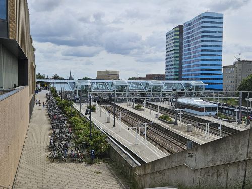
| + | 2024-08-04_51_5_Arnhem_Centraal.jpeg|Leaving the station | ||
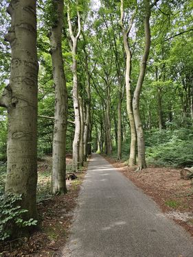
| + | 2024-08-04_51_5_Forest_Road.jpeg|Not that rare, but I love these paths surrounded by trees | ||
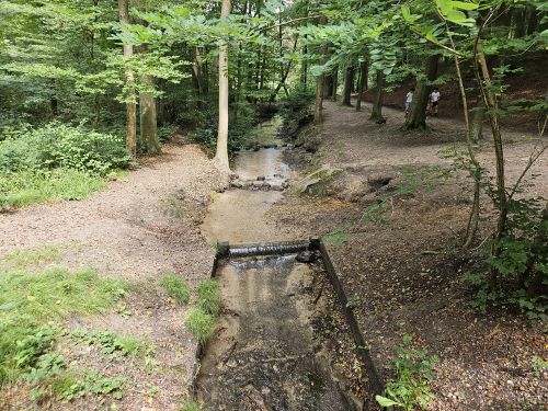
| + | 2024-08-04_51_5_Forest_Creek.jpeg|I love these small water crossings as well | ||
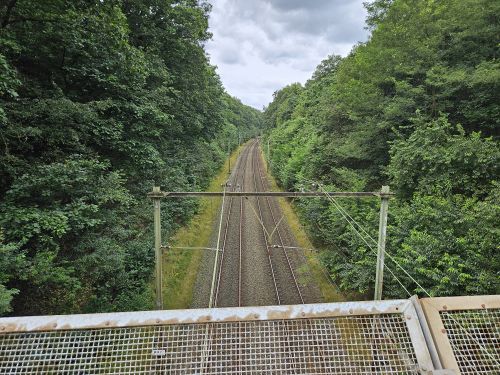
| + | 2024-08-04_51_5_Train_tracks.jpeg|And for the symmetry, another picture of a path going into the distance | ||
| + | 2024-08-04_51_5_Success.jpeg| Hash reached! | ||
| + | 2024-08-04_51_5_Panorama.jpeg|Panorama | ||
| + | 2024-08-04_51_5_Selfie.jpeg| Selfie time! | ||
| + | 2024-08-04_51_5_Hash.jpeg| Picture of the actual hash | ||
| + | 2024-08-04 51 5 De Duiker.jpeg| Apparently this is seen as a correct | ||
| + | </gallery> | ||
| − | == | + | {{Two to the N achievement| count = 4 | date = 2024-08-04 | latitude = 51| longitude = 5| name = MyrtleGlacy |
| − | + | | reached = true | |
| + | }} | ||
| + | |||
| + | |||
| + | [[Category:Expeditions]] | ||
| + | [[Category:Coordinates reached]] | ||
| + | {{location|NL|GE}} | ||
Latest revision as of 10:14, 7 August 2024
| Sun 4 Aug 2024 in 51,5: 51.9904624, 5.8555386 geohashing.info google osm bing/os kml crox |
Contents
Location
Interesting hash on a forest road near Arnhem
Participants
Expedition 1
Looking at the hashes for the weekend, I saw this pretty little hash in a forest near Arnhem. Perfect for an expedition and a long walk afterwards.
I got on the train in Tilburg with my girlfriend and had a direct connection to Arnhem. My girlfriend had other things to do beside hashing. I know, weird right. So she left the train at Oss. I exited at Arnhem and after a short drink and muesli bar break, went on my way. The first bit had a slight incline. Nothing major, the biggest height difference between start and finish would 80m. But for the Netherlands, that almost like climbing up Everest.
Anyways, it was quite a pleasant walk to the hash. After leaving Arnhem, it was a forested area with some fields in between. Along my path, there were many blackberry bushes loaded with blackberries, so I definitely took my time to grab some once in a while.
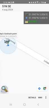
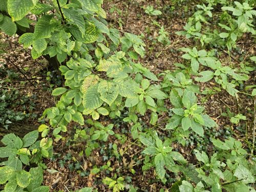
Reaching the hash was easy. It was about 2 meters off a forest path among some plants. Grabbed my screenshot and went on.
As it was a beautiful day, I continued on to first Oosterbeek and then Wolfheze. This entire area was new for me, so it was nice to see what was around me. There was an option to visit some Trappists along the path, but by then my girlfriend was on my way to Arnhem and I wanted to meet up with her.
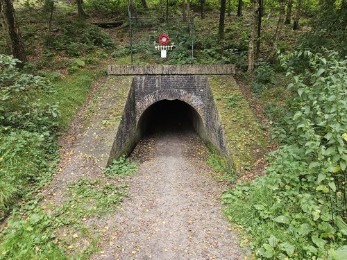
On the final stretch to the Wolfheze train station, I had to go under the train tracks. To do so, I had to go through de Duiker (the Diver), a tiny tunnel about 1.50m at it’s highest. I had to almost crouch to get through, but luckily there was a lack of spiders and other things that might have made this tunnel way more unpleasant.
Reaching the Wolfheze train station, I considered my expedition finished, as I was going back to Arnhem for shopping and dining and it felt like the geohashing part of the day was over.
Photos
MyrtleGlacy earned the Two to the N achievement
|
