Difference between revisions of "2024-08-08 48 16"
(new report) |
(details) |
||
| Line 5: | Line 5: | ||
==Participants== | ==Participants== | ||
*[[User:Fippe|Fippe]] | *[[User:Fippe|Fippe]] | ||
| + | |||
| + | __TOC__ | ||
==Expedition== | ==Expedition== | ||
| − | + | {{User:Fippe/Spree|2024-08-06}} | |
| + | In the afternoon, I walked to ''Wien/Praterstern'', took the subway via ''Wien/Stephansplatz'' to Wien-Westbahnhof, the train to Purkersdorf Central, the bus to ''Allhang/Sportplatzstraße'' and walked the rest of the distance. | ||
| + | |||
| + | Since this was my last day in Austria, I had my suitcase with me, which made the now following hilly ascent challenging. While locating the coordinates, I stumbled through some blackberry bushes, and finally reached them among some grass. After recording proof, I got back on the path and noticed that I had been attacked by raptors, but they did not manage to cut deep. | ||
| + | |||
| + | Afterwards, I walked to the ''Riederberg/Unterer Langleithenweg'' bus stop, took the bus to Purkersdorf Central and the train via Wien-Hütteldorf and Wien Central to the airport. | ||
| + | |||
| + | ==Photos== | ||
| + | <gallery mode="packed" heights="220px"> | ||
| + | 2024-08-08 48 16 01 Site.jpg | My suitcase near the coordinates | ||
| + | 2024-08-08 48 16 03 Geohash.jpg | The Geohash | ||
| + | 2024-08-08 48 16 05 Site.jpg | The site of the Geohash | ||
| + | 2024-08-08 48 16 02 Proof.jpg | Proof | ||
| + | 2024-08-08 48 16 06 Raptor.jpg | Consequences of the raptor attack | ||
| + | 2024-08-08 48 16 04 Surroundings.jpg | Surroundings | ||
| + | </gallery> | ||
| + | |||
| + | ==Tracklog== | ||
| + | {{tracklog|2024-08-08 48 16 09 Tracklog.gpx}} | ||
| + | |||
| + | ==Missed [[Air Geohash]]es== | ||
| + | Later this day, I flew [https://xkcd.com/1937/ from VIE to HAJ]. | ||
| + | |||
| + | I kept my eyes open for Air Geohashes, and there were three instances where I got into a ten-km radius, but nowhere near close enough. Funny enough, the closest I got to any geohash on the plane was the one that I had reached earlier on land. My window was facing the wrong direction though, so instead I had a look at the river Wien's valley. | ||
| + | |||
| + | <gallery mode="packed" heights="280px"> | ||
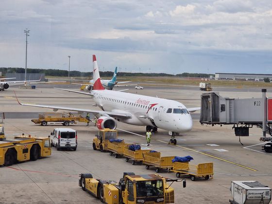
| + | 2024-08-08 VIE E195LR OE-LWQ.jpg | OE-LWQ, an Embraer E195LR, at VIE | ||
| + | 2024-08-08 48 16 08 Closest Aerial.jpg | My closest aerial approach to the coordinates I reached earlier | ||
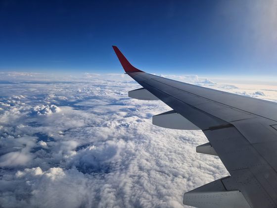
| + | 2024-08-08 48 16 07 Wrong Side.jpg | View to the south-west | ||
| + | </gallery><gallery mode="packed" heights="280px"> | ||
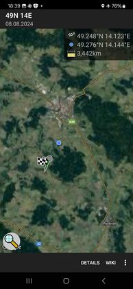
| + | 2024-08-08 49 14 Closest.jpg | Closest distance | ||
| + | 2024-08-08 49 14 Aerial.jpg | and view towards {{egl|2024-08-08|49|14}} in Ražice | ||
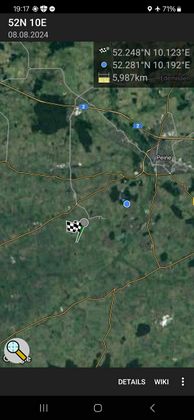
| + | 2024-08-08 52 10 Closest.jpg | Closest distance | ||
| + | 2024-08-08 52 10 Aerial.jpg | and view towards {{egl|2024-08-08|52|10}} in Bierbergen | ||
| + | </gallery> | ||
| + | |||
| + | {{tracklog|2024-08 Fippe flights.gpx}}{{square|0a0}}{{square|00a}} Today's flight<br>{{square|a0a}}{{square|a00}} The flight there two days earlier | ||
| + | |||
| + | ==Ribbons== | ||
| + | {{#vardefine:ribbonwidth|100%}} | ||
| + | {{land geohash|date=2024-08-08|latitude=48|longitude=16|name=[[User:Fippe|Fippe]]|image=2024-08-08 48 16 03 Geohash.jpg}} | ||
| + | {{velociraptor geohash|date=2024-08-08|latitude=48|longitude=16|name=[[User:Fippe|Fippe]]|image=2024-08-08 48 16 06 Raptor.jpg}} | ||
| + | {{regional geohashing|count=2|name=[[User:Fippe|Fippe]]|region=[[User:Fippe/Progress#AT126|Wiener Umland/Nordteil]]|image=AT126 regional Fippe.png}} | ||
__NOTOC__ | __NOTOC__ | ||
| Line 14: | Line 58: | ||
[[Category:Expeditions with photos]] | [[Category:Expeditions with photos]] | ||
{{location|AT|NÖ|PL}} | {{location|AT|NÖ|PL}} | ||
| + | {{user categories|user=Fippe|hours=14|tram=6|train=49|bus=15|foot=5}} | ||
Latest revision as of 21:20, 17 August 2024
| Thu 8 Aug 2024 in 48,16: 48.2480609, 16.1226031 geohashing.info google osm bing/os kml crox |
Location
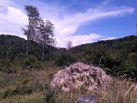
This Geohash is located in a forest in Allhang.
Participants
Contents
Expedition
Trip to Wien
Wien-Ottakring ·
Wagram am Wagram ·
Allhang
In the afternoon, I walked to Wien/Praterstern, took the subway via Wien/Stephansplatz to Wien-Westbahnhof, the train to Purkersdorf Central, the bus to Allhang/Sportplatzstraße and walked the rest of the distance.
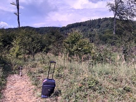
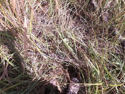
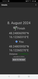
Since this was my last day in Austria, I had my suitcase with me, which made the now following hilly ascent challenging. While locating the coordinates, I stumbled through some blackberry bushes, and finally reached them among some grass. After recording proof, I got back on the path and noticed that I had been attacked by raptors, but they did not manage to cut deep.
Afterwards, I walked to the Riederberg/Unterer Langleithenweg bus stop, took the bus to Purkersdorf Central and the train via Wien-Hütteldorf and Wien Central to the airport.
Photos
Tracklog
Missed Air Geohashes
Later this day, I flew from VIE to HAJ.
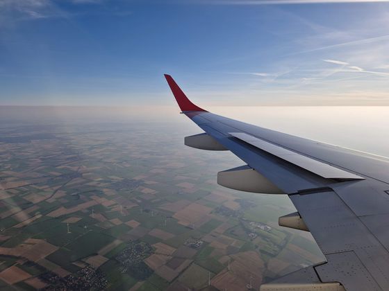
I kept my eyes open for Air Geohashes, and there were three instances where I got into a ten-km radius, but nowhere near close enough. Funny enough, the closest I got to any geohash on the plane was the one that I had reached earlier on land. My window was facing the wrong direction though, so instead I had a look at the river Wien's valley.
and view towards 2024-08-08 49 14 in Ražice
and view towards 2024-08-08 52 10 in Bierbergen
Today's flight
The flight there two days earlier
Ribbons
Fippe earned the Land geohash achievement
|
Fippe earned the Velociraptor Geohash Achievement
|
Fippe earned the Regional geohashing achievement
|
- Meetup on 2024-08-08
- Meetup in 48 16
- Expeditions with tracklogs
- Land geohash achievement
- Velociraptor geohash achievement
- Regional geohashing achievement
- Expeditions
- Coordinates reached
- Expeditions with photos
- Meetup in Bezirk St. Pölten-Land
- Expeditions by Fippe
- Fippe's expeditions by bus
- Fippe's expeditions on foot
- Fippe's expeditions by train
- Fippe's expeditions by tram
