Difference between revisions of "2008-11-20 50 10"
imported>Danatar |
imported>Danatar (changed to "not reached") |
||
| Line 17: | Line 17: | ||
| − | + | I cycled about 2*1.2 km (home - Würzburg train station) + 2* 8.9 km (Haßfurt train station - hashpoint) = 20.2 km. My odometer says 0.006 km total distance, but I tend to believe Google Maps on this one. | |
| − | + | ||
| + | Note: I initially considered this expedition as "coordinates reached", but reevaluation tells me 90 metres is too far away. | ||
<gallery> | <gallery> | ||
| Line 25: | Line 26: | ||
Image:2008-11-20 50 10 sechsthal.jpg|Sechsthal town sign (it's tempting to translate the name's phonetics (Sextal) as "valley of sex", but my first and only impression of the town does not fit well with that) | Image:2008-11-20 50 10 sechsthal.jpg|Sechsthal town sign (it's tempting to translate the name's phonetics (Sextal) as "valley of sex", but my first and only impression of the town does not fit well with that) | ||
Image:2008-11-20 50 10 waldrand.jpg|Picture taken at the edge of the trees near the hashpoint, 50.0578 10.6037. No the original brightness ;-) | Image:2008-11-20 50 10 waldrand.jpg|Picture taken at the edge of the trees near the hashpoint, 50.0578 10.6037. No the original brightness ;-) | ||
| − | Image:2008-11-20 50 10 hp.jpg|Coordinates reached | + | Image:2008-11-20 50 10 hp.jpg|Coordinates not reached. |
</gallery> | </gallery> | ||
| Line 31: | Line 32: | ||
[[Category:Expeditions with photos]] | [[Category:Expeditions with photos]] | ||
[[Category:Expedition without GPS]] | [[Category:Expedition without GPS]] | ||
| − | [[Category:Coordinates reached]] | + | [[Category:Coordinates not reached]] |
| + | [[Category:Not reached - Mother Nature]] | ||
[[Category:Danatar]] | [[Category:Danatar]] | ||
Revision as of 16:58, 23 May 2010
| Thu 20 Nov 2008 in Gotha: 50.0567020, 10.6033959 geohashing.info google osm bing/os kml crox |
Location
Today's location is in a forest near Altershausen and Sechsthal.
Expedition (Danatar)
I took the train from Würzburg to Haßfurt, then went in darkness by bike to the hashpoint.
The full report is on the 2008-11-20 50 9 page, chapter 4 of the story.
I cycled about 2*1.2 km (home - Würzburg train station) + 2* 8.9 km (Haßfurt train station - hashpoint) = 20.2 km. My odometer says 0.006 km total distance, but I tend to believe Google Maps on this one.
Note: I initially considered this expedition as "coordinates reached", but reevaluation tells me 90 metres is too far away.

Haßfurt train station
Sechsthal town sign (it's tempting to translate the name's phonetics (Sextal) as "valley of sex", but my first and only impression of the town does not fit well with that)
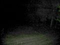
Picture taken at the edge of the trees near the hashpoint, 50.0578 10.6037. No the original brightness ;-)
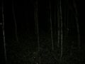
Coordinates not reached.


