Difference between revisions of "2009-05-11 39 -88"
imported>Excellentdude m (A little closer, but still not done) |
imported>Excellentdude m (Pics done! Finally. Story to come!) |
||
| Line 66: | Line 66: | ||
Image:2009-05-11 39 -88 From Hashish 4.jpg|Ditto | Image:2009-05-11 39 -88 From Hashish 4.jpg|Ditto | ||
Image:2009-05-11 39 -88 Nearest Island.jpg|The nearest island, causing further hash location confusion | Image:2009-05-11 39 -88 Nearest Island.jpg|The nearest island, causing further hash location confusion | ||
| + | </gallery> | ||
| + | === Getting Back Out === | ||
| + | <gallery perrow="5"> | ||
| + | Image:2009-05-11 39 -88 Different Way Out.jpg|Let's try going more inland on the way out | ||
| + | Image:2009-05-11 39 -88 A Path.jpg|Better already: a path | ||
| + | Image:2009-05-11 39 -88 A Road.jpg|Even better: a road! | ||
| + | Image:2009-05-11 39 -88 Beaten But Leading.jpg|A long abandoned road, but leading somewhere nonetheless | ||
| + | Image:2009-05-11 39 -88 OK Gravel.jpg|It turned into gravel, but still went somewhere | ||
| + | Image:2009-05-11 39 -88 Raccoon Alpha.jpg|Scary raccoon | ||
| + | Image:2009-05-11 39 -88 Raccoon Beta.jpg|Maybe you can see the raccoon better here | ||
| + | Image:2009-05-11 39 -88 Culvert.jpg|Old culvert, indicating this used to be fairly traveled | ||
| + | Image:2009-05-11 39 -88 Just Gets Better.jpg|Maybe I can go along the edge of this field | ||
| + | Image:2009-05-11 39 -88 No Trespassing Post.jpg|No trespassing | ||
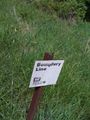
| + | Image:2009-05-11 39 -88 Army Corps Marker.jpg|So I'll stay along the edge on the Army Corps side | ||
| + | Image:2009-05-11 39 -88 More Traditional NTS.jpg|More traditional no trespassing sign | ||
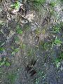
| + | Image:2009-05-11 39 -88 Tracks Alpha.jpg|Others have been here recently | ||
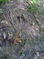
| + | Image:2009-05-11 39 -88 Tracks Beta.jpg|Deer, I think? | ||
| + | Image:2009-05-11 39 -88 Grassy Tracks.jpg|No more road or path, but wheeled tracks leading somewhere | ||
| + | Image:2009-05-11 39 -88 Domesticated Pines.jpg|Domesticated pines; must be close to something | ||
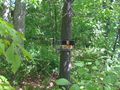
| + | Image:2009-05-11 39 -88 Ambiguous Markers.jpg|One of the ambiguous markers | ||
| + | Image:2009-05-11 39 -88 Somewhere.jpg|Maybe this barn is near a house and/or road? | ||
| + | Image:2009-05-11 39 -88 Twenty Acres.jpg|Twenty acres of this unfolded before me, like a seen from "Pushing Daisies" | ||
| + | Image:2009-05-11 39 -88 Civilization.jpg|Civilization! The house I started at! | ||
| + | Image:2009-05-11 39 -88 Familiar Driveway.jpg|So let's head out to the road... | ||
| + | Image:2009-05-11 39 -88 Where It Started.jpg|And to where I parked by the bridge... | ||
| + | Image:2009-05-11 39 -88 Parked.jpg|Whew! | ||
| + | Image:2009-05-11 39 -88 Usual Local Activity.jpg|What people usually do around here | ||
| + | Image:2009-05-11 39 -88 The Songs.jpg|Later I found these songs... | ||
| + | Image:2009-05-11 39 -88 The Replica.jpg|And this replica... | ||
| + | Image:2009-05-11 39 -88 The Two Story Outhouse.jpg|At the two-story outhouse?!? | ||
</gallery> | </gallery> | ||
=== My Best Imitation of a Track Log === | === My Best Imitation of a Track Log === | ||
Revision as of 18:00, 21 May 2009
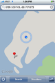
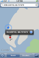
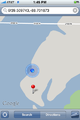
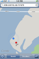
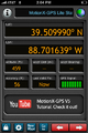
| Mon 11 May 2009 in Decatur: 39.5097432, -88.7016731 geohashing.info google osm bing/os kml crox |
Contents
About
Expedition
excellentdude: Although this was my twentieth geohashing expedition, this was clearly my baptism in geohashing, far surpassing my most difficult previous expedition which was probably 2009-03-09 38 -91. Extensive photos and details to come.
Achievements
excellentdude earned the Land geohash achievement
|
Photos
The Beginning of the Journey
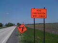
Short delay, but yea stimulus package!
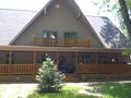
The house of the friendly man
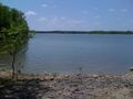
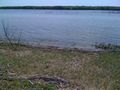
The lake just beneath the bridge
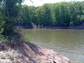
OK, hiking right along the shore won't work
Let's try again here
Hello fellow traveler!
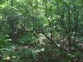
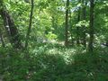
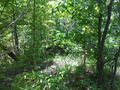
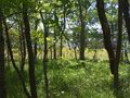
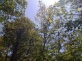
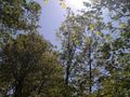
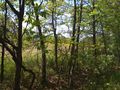
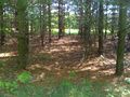
The forest becomes more dense
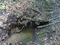
Small waterfall, bigger sound
Typical steep slope I repeatedly faced
Wasn't expecting to find a bridge!
Much less two!
Still hiking near shore as planned
Wow, that looks easier to hike through
And it is!
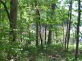
But then I had to return to the forest
I'm getting close to the hash
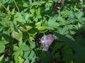
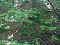
The bush is always densest just before the hash
I made it!
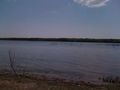
No, I didn't, but a nice view nonetheless
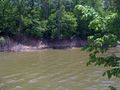
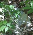
This unmapped inlet caused my error
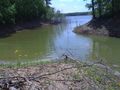
Made it around the inlet
I don't think this goes here
Taken from the buoy
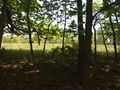
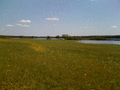
Could I have been hiking through fields this whole time?
Sticking to the original plan near the shore
The hash is in this clearing! For real!


Arrival at the Hash
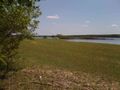
This is the clearing! The hash has to be here! And those geese beat me to it!
A solitary non-goose bird greeted me
I didn't realize how high the water was at the time
As I approached, the geese flew
They landed to the east
Almost there!
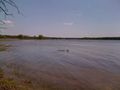
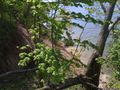
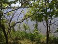
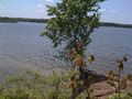
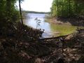
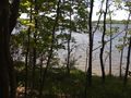
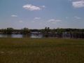
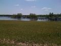
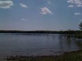
A view of the lake from the hash
Another more to the southwest

Tired goofy grin
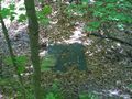
The hash itself, either on the land or shortly into the water
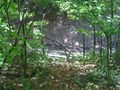
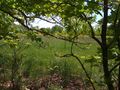
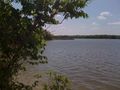
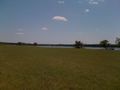
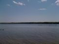
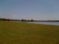
More views from the hash
Ditto
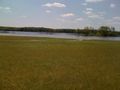
The nearest island, causing further hash location confusion


Getting Back Out
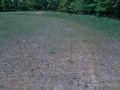
Let's try going more inland on the way out
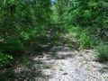
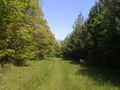
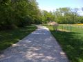
Better already: a path
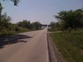
Even better: a road!
A long abandoned road, but leading somewhere nonetheless
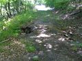
It turned into gravel, but still went somewhere
Scary raccoon
Maybe you can see the raccoon better here
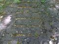
Old culvert, indicating this used to be fairly traveled
Maybe I can go along the edge of this field
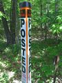
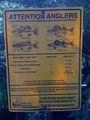
No trespassing
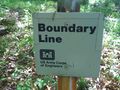
So I'll stay along the edge on the Army Corps side
More traditional no trespassing sign
Others have been here recently
Deer, I think?
No more road or path, but wheeled tracks leading somewhere
Domesticated pines; must be close to something
One of the ambiguous markers
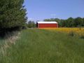
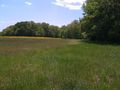
Maybe this barn is near a house and/or road?
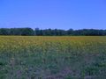
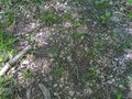
Twenty acres of this unfolded before me, like a seen from "Pushing Daisies"

Civilization! The house I started at!
So let's head out to the road...
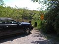
And to where I parked by the bridge...
Whew!
What people usually do around here
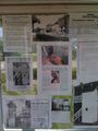
Later I found these songs...
And this replica...
At the two-story outhouse?!?


My Best Imitation of a Track Log
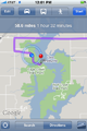
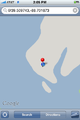
Google directions take you to the nearest road to the hash...
...which isn't always where you want to go
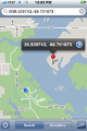
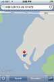
I made it around the inlet! The rest should be easy!
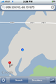
Slowly progressing near the shoreline
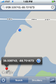
Wait a minute!
OK, that makes more sense
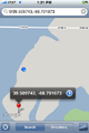
Getting closer...
...and closer...
I think I made it
Things aren't matching, but I think I made it
Zoomed out for similar perspective to others
On the way back, trying to find a better path inland


