Difference between revisions of "2009-11-08 48 8"
From Geohashing
imported>Thepiguy (+pi pictures) |
imported>Ekorren (→Gallery: More photos) |
||
| Line 21: | Line 21: | ||
<gallery> | <gallery> | ||
| + | Image:2009-11-08_48_8_e_Gaeurandweg-Symbol.JPG|Follow the red <s>herring</s> hip | ||
| + | Image:2009-11-08_48_8_e_Ortsausgangsschild_Stammheim.jpg|Leaving Stammheim. Would be 5 km to the station along the road. | ||
| + | Image:2009-11-08_48_8_e_Stammheim_View_back.jpg|View back on Stammheim | ||
Image:2009-11-08_48_8_feet.JPG|Walking along the forest trail. | Image:2009-11-08_48_8_feet.JPG|Walking along the forest trail. | ||
Image:2009-11-08_48_8_gps.JPG|Geohash confirmed! | Image:2009-11-08_48_8_gps.JPG|Geohash confirmed! | ||
| + | Image:2009-11-08_48_8_e_GPS.jpg|Double confirmation | ||
| + | Image:2009-11-08_48_8_e_Koepfel_Marker.jpg|Shooting the marker | ||
| + | Image:2009-11-08_48_8_e_Pi_Tripod.jpg|Preparing group photo... | ||
Image:2009-11-08_48_8_hashers.JPG|Geohashers unite! | Image:2009-11-08_48_8_hashers.JPG|Geohashers unite! | ||
Image:2009-11-08_48_8_flag.JPG|thepiguy finds the final piece... | Image:2009-11-08_48_8_flag.JPG|thepiguy finds the final piece... | ||
Image:2009-11-08_48_8_shades.JPG|... and gets out the shades! | Image:2009-11-08_48_8_shades.JPG|... and gets out the shades! | ||
| + | Image:2009-11-08_48_8_e_View_from_hash_1.jpg|View from hash | ||
| + | Image:2009-11-08_48_8_e_View_from_hash_2.jpg|View from hash | ||
| + | Image:2009-11-08_48_8_e_AlpinerWeg.jpg|"Attention! Partly alpine way" - how bad can it get? | ||
| + | Image:2009-11-08_48_8_e_Ladder_to_nowhere.jpg|Ladder to nowhere | ||
| + | Image:2009-11-08_48_8_e_Moat.jpg|The moat kept us from conquering a castle that wasn't there anyway. | ||
| + | Image:2009-11-08_48_8_e_Radfahrer_verboten.jpg|This once read: Bicyclists forbidden. We would soon find out why: | ||
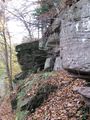
| + | Image:2009-11-08_48_8_e_Rocks.jpg|There were cliffs. | ||
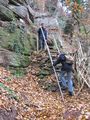
| + | Image:2009-11-08_48_8_e_Ladder_1.jpg|Ladder to somewhere | ||
| + | Image:2009-11-08_48_8_e_Treeees.jpg|More treeeeees... | ||
</gallery> | </gallery> | ||
Revision as of 11:52, 9 November 2009
| Sun 8 Nov 2009 in 48,8: 48.6808936, 8.7485891 geohashing.info google osm bing/os kml crox |
Contents
Location
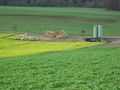
A field at the westernmost margin of the Oberes Gäu hills, between the villages of Stammheim and Holzbronn, which both are incorporated to Calw.
Participants
Expedition
Gallery
Follow the red
herringhip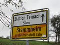
Leaving Stammheim. Would be 5 km to the station along the road.
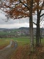
View back on Stammheim
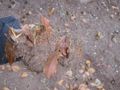
Walking along the forest trail.
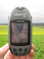
Geohash confirmed!
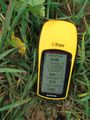
Double confirmation
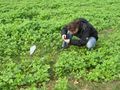
Shooting the marker
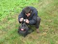
Preparing group photo...
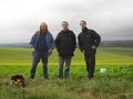
Geohashers unite!
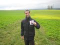
thepiguy finds the final piece...
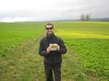
... and gets out the shades!
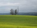
View from hash
View from hash
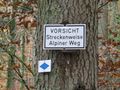
"Attention! Partly alpine way" - how bad can it get?
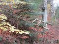
Ladder to nowhere

The moat kept us from conquering a castle that wasn't there anyway.
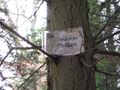
This once read: Bicyclists forbidden. We would soon find out why:
There were cliffs.
Ladder to somewhere
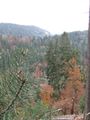
More treeeeees...


