Difference between revisions of "2010-02-15 45 -121"
imported>Aperfectring (a live expedition message sent via geohashdroid for android.) |
imported>Jiml (First pass at my report) |
||
| Line 22: | Line 22: | ||
<!-- how it all turned out. your narrative goes here. --> | <!-- how it all turned out. your narrative goes here. --> | ||
| + | We set out from Hillsboro around lunchtime. | ||
| + | |||
| + | So, we stopped at a little hole-in-the-wall, but very good Dim Sum place in Beaverton. (There were a few leftovers, so the | ||
| + | plan was to eat them at the hashpoint to count it as a Picnic, but we forgot to grab then when we got out of the | ||
| + | car at the hashpoint.) | ||
| + | Then we continued on through | ||
| + | Portland, being worried at the amount of traffic we saw. However, the traffic faded as we continued east through | ||
| + | the Gorge, enjoying the scenery and the views of Mount Hood and the Columbia. | ||
| + | |||
| + | As we got closer, Jim's GPS started to report that it was much closer than APR's navigation unit, so Jim started | ||
| + | to tear things apart to see how he had mucked up the coordinates. But as we crossed over the Columbia and turned onto | ||
| + | the road to the Dock, the GPS said it was only .1 miles, which was good. | ||
| + | |||
| + | We found a parking place, and became concerned over the "No Trespassing" signs we saw in various places. However, the | ||
| + | access path that we found was clear, so we headed in. It was quite an upward trek to the hashpoint, with a fairly | ||
| + | steep dropoff at one point, but we made it to the hashpoint and back safely. There were a bunch of Canadians hanging | ||
| + | around up there. (The honking kind, that is.... You know, with two legs.... and a couple of wings.... | ||
| + | No, not like Robyn's wings... These have feathers....) | ||
| + | |||
| + | We took photos and headed back to home. | ||
*Success! Another graticule has been visited by two intrepid geohashers! -- [[User:Aperfectring|aperfectring]] [http://www.openstreetmap.org/?lat=45.62423535&lon=-121.13139633333333&zoom=16&layers=B000FTF @45.6242,-121.1314] 23:00, 15 February 2010 (UTC) | *Success! Another graticule has been visited by two intrepid geohashers! -- [[User:Aperfectring|aperfectring]] [http://www.openstreetmap.org/?lat=45.62423535&lon=-121.13139633333333&zoom=16&layers=B000FTF @45.6242,-121.1314] 23:00, 15 February 2010 (UTC) | ||
| Line 28: | Line 48: | ||
== Photos == | == Photos == | ||
| − | + | ||
| − | |||
| − | |||
<gallery perrow="4"> | <gallery perrow="4"> | ||
| − | Image:2010-02-15_45_-121_14-45-14-210.jpg | 100 miles, and | + | Image:2010-02-15_45_-121_14-45-14-210.jpg | 100 miles, and Jim and I see this... [http://www.openstreetmap.org/?lat=45.62452638333333&lon=-121.12854081666667&zoom=16&layers=B000FTF @45.6245,-121.1285] |
</gallery> | </gallery> | ||
| − | |||
| − | |||
| − | |||
| − | |||
| − | |||
| − | |||
[[Category:Expeditions]] | [[Category:Expeditions]] | ||
| − | + | [[Category:Expeditions with photos]] | |
| − | [[Category:Expeditions with photos]] | ||
| − | |||
| − | |||
| − | |||
| − | |||
| − | |||
[[Category:Coordinates reached]] | [[Category:Coordinates reached]] | ||
| − | |||
| − | |||
| − | |||
| − | |||
| − | |||
| − | |||
| − | |||
| − | |||
| − | |||
| − | |||
Revision as of 06:35, 16 February 2010
| Mon 15 Feb 2010 in 45,-121: 45.6243272, -121.1314454 geohashing.info google osm bing/os kml crox |
Location
Near the Columbia River in The Dales, Oregon
Participants
Plans
We're planning to head there on Monday...
Expedition
We set out from Hillsboro around lunchtime.
So, we stopped at a little hole-in-the-wall, but very good Dim Sum place in Beaverton. (There were a few leftovers, so the plan was to eat them at the hashpoint to count it as a Picnic, but we forgot to grab then when we got out of the car at the hashpoint.) Then we continued on through Portland, being worried at the amount of traffic we saw. However, the traffic faded as we continued east through the Gorge, enjoying the scenery and the views of Mount Hood and the Columbia.
As we got closer, Jim's GPS started to report that it was much closer than APR's navigation unit, so Jim started to tear things apart to see how he had mucked up the coordinates. But as we crossed over the Columbia and turned onto the road to the Dock, the GPS said it was only .1 miles, which was good.
We found a parking place, and became concerned over the "No Trespassing" signs we saw in various places. However, the access path that we found was clear, so we headed in. It was quite an upward trek to the hashpoint, with a fairly steep dropoff at one point, but we made it to the hashpoint and back safely. There were a bunch of Canadians hanging around up there. (The honking kind, that is.... You know, with two legs.... and a couple of wings.... No, not like Robyn's wings... These have feathers....)
We took photos and headed back to home.
- Success! Another graticule has been visited by two intrepid geohashers! -- aperfectring @45.6242,-121.1314 23:00, 15 February 2010 (UTC)
Tracklog
Photos
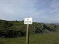
100 miles, and Jim and I see this... @45.6245,-121.1285
