Difference between revisions of "2010-07-09 60 10"
imported>FippeBot m (Location) |
m (2020-01-01 update) |
||
| Line 75: | Line 75: | ||
[[Category:Expeditions with photos]] | [[Category:Expeditions with photos]] | ||
[[Category:Coordinates reached]] | [[Category:Coordinates reached]] | ||
| − | {{location|NO| | + | {{location|NO|34}} |
Latest revision as of 00:21, 16 February 2020
| Fri 9 Jul 2010 in 60,10: 60.3316352, 10.4224447 geohashing.info google osm bing/os kml crox |
Location
On a bewildered hillside, near Grymyr, Norway.
Today's battleship location is: E 4
Participants
- relet 20:02, 9 July 2010 (UTC)
Plans
Cycle 25km. Dance the hash. Cycle back.
Expedition
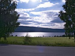
There's not too much to tell about this one, but I get a feeling I should write it up before the memory vanishes. I also had a feeling that I haven't been hashing for way too long, and this looked like a nice après-work expedition. So I packed a small pack, and left home around 5pm. The weather was rather sunny and warm, but nothing extreme like in the rest of Europe.
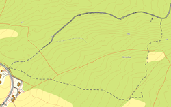
I enjoyed the landscape, and discovered a few new cycling tracks and was again surprised by them being rather well signed out. With my usual leisurely pace, I reached the vicinity of Grymyr some 25km and maybe 1h30 later. I knew from my maps that I had to leave the road at a bend where a track would go in the direction of some woods. And then the hash would be on my right hand.
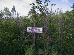
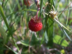
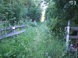
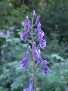
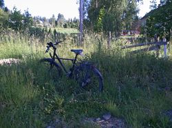
So that's what I did. I found an empty meadow at the bend in the road with the gates wide open, and an obvious trampled path across to where I was expecting the track. I locked and left Trusty, and teetered through the wild flowers and stuff. Having to cycle on a warm day, I was in shorts. The meadow was a nice one, which turned into a plantation of sorts after a while, where I found wild strawberries. A little later, the woods began, and I began to be haunted by what I thought were mosquitoes - after getting a bit hectic about their sheer number for half an hour, I realized that most of them were just obnoxiously loud flies. There was the odd horsefly among them, which you could recognize by the deeper buzz.
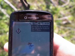
When I reached the coordinates in the middle of a dense pine forest with lots of flies around, geohashdroid adamantly refused to give me a good coordinates reached picture, and instead reported the hash to be some 300m away. I cursed the software for a while, until I realized that it was right and I was wrong. I had mistyped one half of the coordinate pair earlier, and entered my current latitude as destination.
Now, surprisingly the correct hash popped up on the other side of the track. I did not expect that. I followed it a bit further, to where it got muddy, just to see if the path would turn. It did fork instead, and one of the two options headed right towards the hash. Only to end in a field. I crossed the field along its edge, and ended up right in front of a dense row of nettles.
Now, if there is one thing you learn from geohashing, then that obstacles are overcome iteratively. If you have crossed obstacles or distances of various difficulties summing up to X, then encountering any obstacle of a difficulty x<X will make you say: "I didn't do all that X just to get thwarted by this x here." I call it the Principle of Escalating Madness, since it easily allows every new obstacle to be way larger than the ones you have encountered so far, if only you have overcome enough small obstacles.
And you've never heard of anyone being nettled-to-death-in-his-shorts, have you?
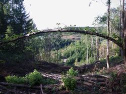
Hence, I started trampling some nettles to clear a safe passage to the forest on the other side of the field. I felt my legs burning a bit, but nothing serious happened, and the feeling subsided before I could think too much about it. Crossing the forest was a bit easier, and had me ending up in some tractor tracks. Now, you can easily imagine a tractor plowing through a field, or a forest machine cutting away some trees. This one must have come up a 35% slope, cutting away the trees in its path, leaving only stumps and splintered pieces of chopped wood. I had trouble following the tracks down the hill, with the GPS in one hand. I eventually stowed it away, so that I could try to find some non-splintery hold for my hands.
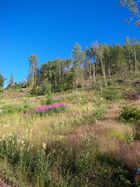
At the bottom of the hill there was the track that I apparently wanted to take in the first place. I emptied the wooden splinters out of my shoes, and followed it for a few dozen meters, to the point where the hash was again 30m up the hill. There were some tracks here, too, but most of what I had as a forest in my map was another (if hillier) wild meadow. With more strawberries.
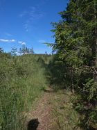
I spent some time scrambling along that slope, eating berries and trying to convince my GPS to display something useful. After reaching the coordinates, I was able to follow "my" track back, which ended in exactly that derelict meadow I had started my expedition in - except in the less trampled but much closer corner I didn't take a close look at.
Photos
|
