Difference between revisions of "2011-01-21 66 25"
From Geohashing
imported>Isopekka (→Photos) |
imported>Isopekka |
||
| Line 1: | Line 1: | ||
| − | [[Image: | + | [[Image:Gh1-2011 008.JPG|thumb|left]] |
| Line 20: | Line 20: | ||
* [[User:isopekka|isopekka]] | * [[User:isopekka|isopekka]] | ||
| + | |||
| Line 25: | Line 26: | ||
Planning to visit the hash at first midnight... | Planning to visit the hash at first midnight... | ||
| + | |||
| Line 34: | Line 36: | ||
* Walking total about 100 m | * Walking total about 100 m | ||
* Physical efforts needed (1-5): 1 | * Physical efforts needed (1-5): 1 | ||
| − | |||
| Line 60: | Line 61: | ||
</gallery> | </gallery> | ||
| + | |||
| + | |||
== Achievements == | == Achievements == | ||
| Line 92: | Line 95: | ||
}} | }} | ||
| + | |||
Revision as of 23:17, 20 January 2011
| Fri 21 Jan 2011 in 66,25: 66.5010444, 25.7825491 geohashing.info google osm bing/os kml crox |
Contents
Location
In the city of Rovaniemi, only 1.49 km from my home (as the crow flies).
Participants
Plan
Planning to visit the hash at first midnight...
Expedition
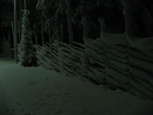
succeeded, more text later
- By car total 5 km
- Walking total about 100 m
- Physical efforts needed (1-5): 1
Photos
Achievements
isopekka earned the Land geohash achievement
|
isopekka earned the Frozen Geohash Achievement
|
isopekka earned the Midnight Geohash achievement
|
Other Geohashing Expeditions and Plans on This Day
Expeditions and Plans
| 2011-01-21 | ||
|---|---|---|
| Atlanta, Georgia | NWoodruff | In the middle of a road in Lilburn Georgia |
| Zürich, Switzerland | Wuestenschiff | On the border between the town of Winterthur and the village Elsau |
| Hamburg (West), Germany | Hermann | An apple farm near "Buxtehude". |
| Tampere, Finland | Laiti | The spot is located at Tammela near Tampere city centre. Very urban area. |
| Rovaniemi, Finland | isopekka | In the city of Rovaniemi, only 1.49 km from home (as the crow flies). |


