Difference between revisions of "2011-03-13 50 11"
imported>Paintedhell (Expedition planned.) |
imported>Paintedhell (Expedition report and photos.) |
||
| Line 14: | Line 14: | ||
Anyone joining me? | Anyone joining me? | ||
| − | [[Category: | + | == Participants == |
| + | * [[User:Paintedhell|Juja]] and Ninja J | ||
| + | |||
| + | == Expedition == | ||
| + | The weather was fine and today's hash point was at a distance of not even 6 kms (as the crow flies), so I took the chance to go on a nice Sunday walk and take my favorite Ninja with me. | ||
| + | |||
| + | We started to climb the Jenzig (my backyard mountain) and then walk the "Hufeisen" (the way is called horseshoe because of its shape) and just took a quick detour to the point in Jenalöbnitz. Since my GPS device is temporarily dead, I had to remember how to read maps, but it worked out quite well and we found the point without problems, located on a sunny field. Then I collected some stones to mark the spot, made an xkcd sign and my Ninja took some pictures while in the background a tractor was already approaching. Soon we understood the danger: the tractor had full speed and didn't seem willing to brake for geohashers, especially not the kind collecting stones on his field. He made closer circles around us, and we ran for our lives, reached the side of the field before he came for us, but he followed us on the way - probably only to frighten us, because when we ran on, he just drove back to the field. | ||
| + | |||
| + | To recover from that adventure, we completed our walk including the ruin of Kunitzburg - so in the end the walk was 18 kms long and made us hungry enough to really enjoy the afternoon tea and cake... | ||
| + | |||
| + | == Photos == | ||
| + | {{gallery|width=200|height=200|lines=3 | ||
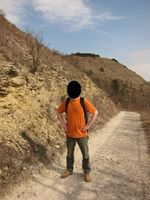
| + | |Image:Geo_110313_50_11_01.jpg|Ninja on the way to the hash. | ||
| + | |Image:Geo_110313_50_11_02.jpg|Yaaay, it's a kitty! Some minutes of distraction. | ||
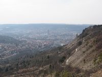
| + | |Image:Geo_110313_50_11_03.jpg|View back to Jena. | ||
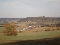
| + | |Image:Geo_110313_50_11_04.jpg|View to the hashpoint - on the field in the background. | ||
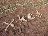
| + | |Image:Geo_110313_50_11_05.jpg|Marked the spot - no proof of location this time... | ||
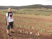
| + | |Image:Geo_110313_50_11_06.jpg|Grinning geohasher with evil tractor in the background. | ||
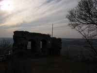
| + | |Image:Geo_110313_50_11_07.jpg|Ruin of Kunitzburg in the late afternoon. | ||
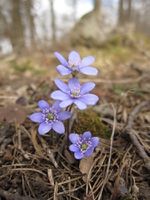
| + | |Image:Geo_110313_50_11_08c.jpg|Springtime approaching (1): liverworts on Jenzig. | ||
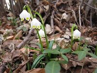
| + | |Image:Geo_110313_50_11_08d.jpg|Springtime approaching (2): spring snowflakes near Kunitzburg. | ||
| + | |||
| + | }} | ||
| + | |||
| + | [[Category:Expeditions]] | ||
| + | [[Category:Expeditions with photos]] | ||
| + | [[Category:Coordinates reached]] | ||
Revision as of 20:31, 13 March 2011
| Sun 13 Mar 2011 in 50,11: 50.9435178, 11.6850212 geohashing.info google osm bing/os kml crox |
Location
On a probably dirty, muddy field on the edge of Jenalöbnitz.
Plans
Juja will go there without a GPS and will have to guess which point in the mud is right. The point is in walking distance, so I can't say now whether I'll go by bike or just walk/run there. Let's see. I'll probably go in the afternoon, maybe earlier. I couldn't be much more vague. ;)
Anyone joining me?
Participants
- Juja and Ninja J
Expedition
The weather was fine and today's hash point was at a distance of not even 6 kms (as the crow flies), so I took the chance to go on a nice Sunday walk and take my favorite Ninja with me.
We started to climb the Jenzig (my backyard mountain) and then walk the "Hufeisen" (the way is called horseshoe because of its shape) and just took a quick detour to the point in Jenalöbnitz. Since my GPS device is temporarily dead, I had to remember how to read maps, but it worked out quite well and we found the point without problems, located on a sunny field. Then I collected some stones to mark the spot, made an xkcd sign and my Ninja took some pictures while in the background a tractor was already approaching. Soon we understood the danger: the tractor had full speed and didn't seem willing to brake for geohashers, especially not the kind collecting stones on his field. He made closer circles around us, and we ran for our lives, reached the side of the field before he came for us, but he followed us on the way - probably only to frighten us, because when we ran on, he just drove back to the field.
To recover from that adventure, we completed our walk including the ruin of Kunitzburg - so in the end the walk was 18 kms long and made us hungry enough to really enjoy the afternoon tea and cake...
Photos
|
