Difference between revisions of "2011-05-27 66 25"
From Geohashing
imported>Isopekka (Created page with "thumb|left {{meetup graticule | lat=66 | lon=25 | date=2011-05-27 }} == Location == 7 km to the E from the city Rovaniemi, on the field. == P...") |
imported>FippeBot m (Location) |
||
| Line 63: | Line 63: | ||
[[Category:Expeditions with photos]] | [[Category:Expeditions with photos]] | ||
[[Category:Coordinates reached]] | [[Category:Coordinates reached]] | ||
| + | {{location|FI|10}} | ||
Latest revision as of 06:41, 9 August 2019
| Fri 27 May 2011 in 66,25: 66.5190957, 25.8469146 geohashing.info google osm bing/os kml crox |
Contents
Location
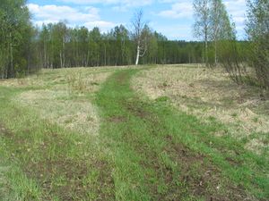
7 km to the E from the city Rovaniemi, on the field.
Participants
Expedition
- By car total 14 km
- Walking total 0.3 km
- Expedition took 0.5 h
- Physical effort (1-5): 1
Photos
Achievements
isopekka earned the Land geohash achievement
|
Geohashing Expeditions and Plans on This Day
Expeditions and Plans
| 2011-05-27 | ||
|---|---|---|
| Sagarmatha, Nepal | Thepiguy | located near Bung. |
| Lansing, Michigan | Flee, *Mikhayla, *Hanna, *Ben | located in a really gross swamp in Pulaski. |
| Duluth, Minnesota | Le Fou | In some swampy woods on private property near Duxbury, MN. |
| Birmingham, United Kingdom | Sourcerer | A mile north east of spaghetti junction, Birmingham, UK. |
| Sheffield, United Kingdom | Monty | Moorland, off of A6024, just north of the Woodhead trans-Pennine road. |
| Rovaniemi, Finland | isopekka | 7 km to the E from the city Rovaniemi, on the field. |


