Difference between revisions of "2011-07-22 51 1"
imported>Sourcerer |
imported>Sourcerer |
||
| Line 40: | Line 40: | ||
Image:2011-07-22_51_1_Sourcerer_16.JPG|Parkston Quay, Harwich | Image:2011-07-22_51_1_Sourcerer_16.JPG|Parkston Quay, Harwich | ||
</gallery> | </gallery> | ||
| + | |||
| + | == Achievements == | ||
| + | |||
| + | [[User:Origo|Origo]] did not go on an expedition on this day. | ||
| + | |||
| + | {{Last man standing | ||
| + | | latitude = 51 | ||
| + | | longitude = 1 | ||
| + | | date = 2011-07-22 | ||
| + | | gender = man | ||
| + | | name = Sourcerer | ||
| + | }} | ||
== Other geohashing expeditions on the same day == | == Other geohashing expeditions on the same day == | ||
Revision as of 11:59, 3 August 2011

Contents
Location
On the promontory that separates the ports of Harwich and Felixtowe. The hashpoint is right on a public footpath.
| Fri 22 Jul 2011 in Canterbury: 51.9646351, 1.2350494 geohashing.info google osm bing/os kml crox |
Participants
Expedition
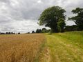
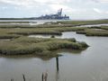
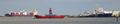
This 12 km walk logged on wikiloc has fine views of the port of Harwich on the Stour estuary and the port of Felixtowe on the Orwell estuary. Felixtowe is the largest container port in the UK. The hashpoint was one pace off the path in a wheat field. This was a most pleasant expedition with the bonus of geohashing success.
Photo Gallery
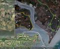
Google Earth Track
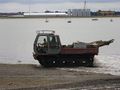
Port Maintenance Vehicle
Serious Marine Engineering
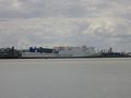
Roll-on-Roll-off Ferry
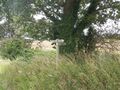
Public Footpath Signs
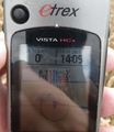
Coordinates Reached
Ripe wheat at the hashpoint
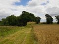
The Footpath
The Footpath

Someone has pimped their ride!
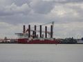
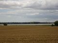
Felixtowe Port
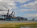
Felixtowe Port
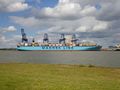
Felixtowe Port
The Harbour Entrance
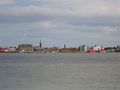
Parkston Quay, Harwich


Achievements
Origo did not go on an expedition on this day.
Sourcerer earned the Last man standing achievement
|
Other geohashing expeditions on the same day
Expeditions and Plans
| 2011-07-22 | ||
|---|---|---|
| Seattle, Washington | Someone went | It figures. The one time the hash point is near my college, I'm home for th... |
| Canterbury, United Kingdom | Sourcerer | On the promontory that separates the ports of Harwich and Felixtowe. The ha... |