Difference between revisions of "2011-10-31 50 10"
imported>Reinhard m (→Expedition: Reinhard) |
imported>Reinhard (→Expedition: Reinhard) |
||
| Line 18: | Line 18: | ||
== Expedition: Reinhard == | == Expedition: Reinhard == | ||
| − | Reinhard preferred waiting for the sunny afternoon and drier roads, before he started his bike trip to the hashpoint. His starting point was just 750 m from Juja's, but his trip was probably less than a quarter identical. He took the road via Schleusingen and Hirschbach and uphill to the porphyry mine near Hirschbach. He knew, that the paved road would end there, but OSM showed a good forest road leading from there to the hashpoint. Reinhard did not find any marks at the hashpoint | + | Reinhard preferred waiting for the sunny afternoon and drier roads, before he started his bike trip to the hashpoint. His starting point was just 750 m from Juja's, but his trip was probably less than a quarter identical. He took the road via Schleusingen and Hirschbach and uphill to the porphyry mine near Hirschbach. He knew, that the paved road would end there, but OSM showed a good forest road leading from there to the hashpoint. Reinhard did not find any marks at the hashpoint but nevertheless thought, that Juja had been there before as she's the earliest-geohasher-type-of-person. He took the standard photos and as using the forest paths by road bike was no problem, he continued his trip towards Stutenhaus with a short side trip to the Adlersberg, where a guy from Switzerland was completely astonished, how Reinhard could get there with a usual road bike. At Stutenhaus he got back on roads and enjoyed the 8 km descent from Schmiedefeld back to Schleusingerneundorf. |
== Photos == | == Photos == | ||
Revision as of 11:22, 1 November 2011
| Mon 31 Oct 2011 in 50,10: 50.5880741, 10.7569918 geohashing.info google osm bing/os kml crox |
Location
In the forest above the Erletor barrage, not far from a way and in nice pre-lunch cycling distance from Neundorf.
Participants
Expedition: Juja
(TODO)
Expedition: Reinhard
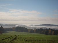
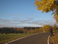
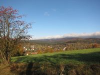
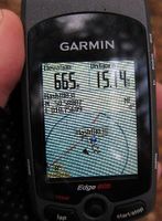
Reinhard preferred waiting for the sunny afternoon and drier roads, before he started his bike trip to the hashpoint. His starting point was just 750 m from Juja's, but his trip was probably less than a quarter identical. He took the road via Schleusingen and Hirschbach and uphill to the porphyry mine near Hirschbach. He knew, that the paved road would end there, but OSM showed a good forest road leading from there to the hashpoint. Reinhard did not find any marks at the hashpoint but nevertheless thought, that Juja had been there before as she's the earliest-geohasher-type-of-person. He took the standard photos and as using the forest paths by road bike was no problem, he continued his trip towards Stutenhaus with a short side trip to the Adlersberg, where a guy from Switzerland was completely astonished, how Reinhard could get there with a usual road bike. At Stutenhaus he got back on roads and enjoyed the 8 km descent from Schmiedefeld back to Schleusingerneundorf.
Photos
|


