Difference between revisions of "2012-03-08 50 11"
imported>Paintedhell (Expedition planned.) |
imported>Paintedhell |
||
| Line 12: | Line 12: | ||
[[User:Paintedhell|Juja]] will cycle there after work, hopefully arriving before sunset and getting back home soon enough for a big noodly dinner. Geohashing company and invitations to big noodly dinners are welcome! | [[User:Paintedhell|Juja]] will cycle there after work, hopefully arriving before sunset and getting back home soon enough for a big noodly dinner. Geohashing company and invitations to big noodly dinners are welcome! | ||
| − | [[Category: | + | == Participants == |
| + | * [[User:Paintedhell|Juja]], Benjy and Frankie Mouse | ||
| + | |||
| + | == Expedition: Juja == | ||
| + | Chances were that today's Geohash point could be on private property - the satellite picture looked like someone's abandoned garden patch. But I still don't have the [[Ambassador achievement]], so I thought I'd give it a try anyway. | ||
| + | |||
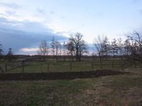
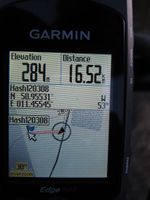
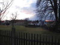
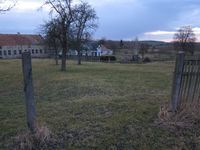
| + | I started right after work and promised Reinhard to send him a message if the point would not be accessible. I know the way to Hammerstedt, so getting there was no problem, and even finding the place... well, I followed my Edgie in low-zoom mode and was just about to congratulate myself for having found the patch and being able to ride my bike right to the point when I zoomed in and noticed that this was obviously another one - the real point was still 50 meters away. And there were fences. So I pushed my bike back on the road and was about to give up and text Reinhard about my failed Geohashing attempt when I noticed that the fence just... vanished after 30 meters. What was left ''could'' have been someone's garden, but if it was, it was a really unprivate and uninhabited garden and so I didn't hesitate to go to the hash, take my photos and mark the way afterwards with a piece of chalky stone I found nearby. Successful Geohash, yay! | ||
| + | |||
| + | == Photos: Juja == | ||
| + | {{gallery|width=200|height=200|lines=2 | ||
| + | |Image:120308_50_11_1.jpg|Found the patch - hey, that was easy! Wait... | ||
| + | |Image:120308_50_11_2.jpg|...the point is still 53m away? | ||
| + | |Image:120308_50_11_3.jpg|And behind a fence, obviously. | ||
| + | |Image:120308_50_11_4.jpg|Well, not so much fence after all. | ||
| + | |Image:120308_50_11_5.jpg|Hashpoint reached! | ||
| + | |Image:120308_50_11_6.jpg|View from the hash. | ||
| + | |Image:120308_50_11_7.jpg|White mouse sitting on dirt - quite a usual picture. | ||
| + | |Image:120308_50_11_8.jpg|Geohashing audience, watching suspiciously. | ||
| + | |Image:120308_50_11_9.jpg|Marked to road for the for the unlikely event of another Geohasher's visit. | ||
| + | }} | ||
| + | |||
| + | [[Category:Expeditions]] | ||
| + | [[Category:Expeditions with photos]] | ||
| + | [[Category:Coordinates reached]] | ||
Revision as of 18:47, 8 March 2012
| Thu 8 Mar 2012 in 50,11: 50.9553095, 11.4554539 geohashing.info google osm bing/os kml crox |
Location
On a small dirty field on the edge of Hammerstedt.
Plans
Juja will cycle there after work, hopefully arriving before sunset and getting back home soon enough for a big noodly dinner. Geohashing company and invitations to big noodly dinners are welcome!
Participants
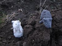
- Juja, Benjy and Frankie Mouse
Expedition: Juja
Chances were that today's Geohash point could be on private property - the satellite picture looked like someone's abandoned garden patch. But I still don't have the Ambassador achievement, so I thought I'd give it a try anyway.
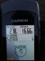
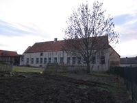
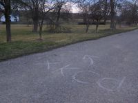
I started right after work and promised Reinhard to send him a message if the point would not be accessible. I know the way to Hammerstedt, so getting there was no problem, and even finding the place... well, I followed my Edgie in low-zoom mode and was just about to congratulate myself for having found the patch and being able to ride my bike right to the point when I zoomed in and noticed that this was obviously another one - the real point was still 50 meters away. And there were fences. So I pushed my bike back on the road and was about to give up and text Reinhard about my failed Geohashing attempt when I noticed that the fence just... vanished after 30 meters. What was left could have been someone's garden, but if it was, it was a really unprivate and uninhabited garden and so I didn't hesitate to go to the hash, take my photos and mark the way afterwards with a piece of chalky stone I found nearby. Successful Geohash, yay!
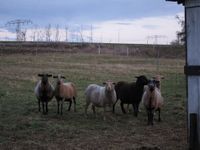
Photos: Juja
|
