Difference between revisions of "2012-05-14 29 -80"
imported>DrCanadianNinja |
imported>DrCanadianNinja |
||
| Line 1: | Line 1: | ||
| + | {{Advert}} | ||
| + | |||
{{meetup graticule | {{meetup graticule | ||
| map=<map lat="29" lon="-80" date="2012-05-14" /> | | map=<map lat="29" lon="-80" date="2012-05-14" /> | ||
Revision as of 16:54, 1 June 2012
| Have you seen our geohashing marker? We'd love to hear from you! Click here to say "hi" and tell us what you've seen!
Curious about what geohashing is? Read more! |
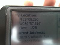
| Mon 14 May 2012 in Daytona Beach Shores, Florida: 29.1377452, -80.9602435 geohashing.info google osm bing/os kml crox |
Expedition
Geohashers
The Plan
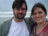
What fortuitous luck! The one day I need to be late at work and therefore get an extended lunch to keep my hours down, a hash appears in this difficult graticule! And it's right on the beach! You bet your ass I'm going for it! Planning to be at the hash around 3:00.
Surprisingly, Erica, who was out with pain just yesterday, swallowed some pills and jumped in with me as soon as I said I was going to a beach hash.
The Adventure
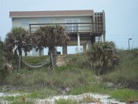
The drive down was, for the most part, uneventful. A stop for gas and slushies and a later pit stop for said slushies was the most exciting thing that happened on the 90 mile drive to Daytona Beach Shores. From there we disembarked onto Dunlawton Avenue, crossed a bridge that totally looked like we were going to ramp the thing action movie style, and then onto South Atlantic. The initial plan was to go to Emilia Avenue, park on the beach and walk over; however, we did see what looked like a toll booth there, so plan B was to park at the nearby Seychelles Condominiums and take a walkway to the beach. As it turned out, the booth was just to close off access to the beach after hours or in case of bad weather. Thankfully, the weather wasn't bad enough... yet. (Am I foreshadowing enough? That was good foreshadowing, right?))
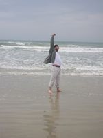
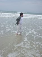
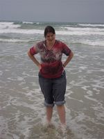
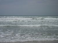
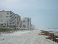
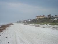
We parked on the beach and set out southwest past a No Traffic zone. I was beginning to wonder if they had a bad enough problem with people driving that way until I saw the No ATVs sign. Yep, that'll do it. It wasn't the prettiest beach I've ever been to, but I grew up near Honeymoon Island by Clearwater, which, well, the name alone should give you an idea of picturesque. However, it was my first time on a Floridian East Coast beach, and it was Erica's first time at an Atlantic Ocean beach, so some firsts were had.
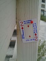
You know what else was a great first? First geohash attempted in the graticule! Which subsequently made us the first to reach one there! Woo! In your face, 98% ocean graticule! I had to laugh when I drew the Two of Diamonds, as it made me think of the now classic Old Spice commercial. "It's an oyster with two tickets to that thing you love! Look again, the tickets are now diamonds!" Word association, it never fails me.
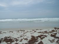
Our timing couldn't have been much better; we had reached the hash at low tide where the water was, at most, hitting our calves. By the time we got back to the car, the water was creeping ever higher, with the occasional wave splashing up to where we were parked. No real danger of having to float the car, but high enough that another half hour and this would've been a water geohash.
Now the trip back... that was something. It had been overcast for a few days, but the only rain was like someone forgot to fully turn off the shower, someone heard the sound and immediately turned it completely off. As we were reaching Jacksonville, the rain started. Just your typical garden variety rainstorm at first, only needed the intermittent wipers. Then it got heavier, and I needed the constant slow wipers. Then it got even heavier, to the point where even the fastest speed was having difficulty keeping up.
Then it got heavier. When I say heavy, I mean I've seen waterfalls put out less water than this. It was genuine white-out conditions, to the point that I turned on my hazard lights so others could see me and to the point that I could only tell I was in my lane with intense focus. Erica was getting worried that, unlike the others around me, I was not pulling off to the side to wait it out. As it turns out, at the time of writing this from home, that storm is rolling in above my head two and a half hours later, so given that I needed to get back to work, which was my driving motivation, that was a good call.
Gallery
- Photo Gallery
Achieveables
Geoff earned the Consecutive geohash achievement
|
Geoff achieved level 3 of the Minesweeper Geohash achievement
|
Geoff earned the Lowest Geohash Achievement
|
