Difference between revisions of "2012-05-21 59 18"
imported>Per S (→Achievements) |
imported>Per S |
||
| Line 1: | Line 1: | ||
| − | + | {| width="100%" border=0 cellpadding=0 cellspacing=0 style="border: 0; border-collapse: collapse; border-spacing: 0; margin: 0; padding: 0" | |
| − | + | | align="left" valign="top" style="padding: 0.5em 1em 0.5em 0" | [[Image:2012-05-21 59 18 20-34-39-219.jpg|border|467px]] | |
| − | -- | + | |
| − | {{meetup graticule | + | | align="right" valign="top" | {{meetup graticule |
| lat=59 | | lat=59 | ||
| lon=18 | | lon=18 | ||
| date=2012-05-21 | | date=2012-05-21 | ||
| + | | graticule_name=Stockholm | ||
| + | | graticule_link=Stockholm, Sweden | ||
}} | }} | ||
| − | + | |} | |
| + | |||
__NOTOC__ | __NOTOC__ | ||
| + | |||
== Location == | == Location == | ||
In a field close to Garnsviken, five miles north-northwest of Åkersberga. | In a field close to Garnsviken, five miles north-northwest of Åkersberga. | ||
| Line 36: | Line 40: | ||
<!-- if your GPS device keeps a log, you may post a link here --> | <!-- if your GPS device keeps a log, you may post a link here --> | ||
| − | == Photos == | + | == Photos == |
| − | + | === Cjk === | |
| − | + | <gallery widths=117px perrow="5"> | |
| − | |||
| − | <gallery perrow="5"> | ||
| − | |||
Image:2012-05-21_59_18_20-33-16-823.jpg | TheNuclearScientist [http://www.openstreetmap.org/?lat=59.54340000&lon=18.26270000&zoom=16&layers=B000FTF @59.5434,18.2627] | Image:2012-05-21_59_18_20-33-16-823.jpg | TheNuclearScientist [http://www.openstreetmap.org/?lat=59.54340000&lon=18.26270000&zoom=16&layers=B000FTF @59.5434,18.2627] | ||
| − | |||
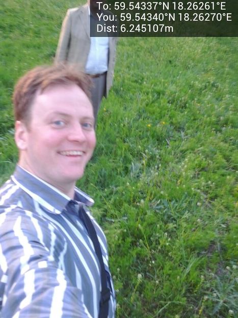
Image:2012-05-21_59_18_20-34-39-219.jpg | Me [http://www.openstreetmap.org/?lat=59.54340000&lon=18.26270000&zoom=16&layers=B000FTF @59.5434,18.2627] | Image:2012-05-21_59_18_20-34-39-219.jpg | Me [http://www.openstreetmap.org/?lat=59.54340000&lon=18.26270000&zoom=16&layers=B000FTF @59.5434,18.2627] | ||
| − | |||
Image:2012-05-21_59_18_20-35-06-169.jpg | [http://www.openstreetmap.org/?lat=59.54370000&lon=18.26250000&zoom=16&layers=B000FTF @59.5437,18.2625] | Image:2012-05-21_59_18_20-35-06-169.jpg | [http://www.openstreetmap.org/?lat=59.54370000&lon=18.26250000&zoom=16&layers=B000FTF @59.5437,18.2625] | ||
| − | |||
Image:2012-05-21_59_18_20-36-35-505.jpg | Orange [http://www.openstreetmap.org/?lat=59.54340000&lon=18.26270000&zoom=16&layers=B000FTF @59.5434,18.2627] | Image:2012-05-21_59_18_20-36-35-505.jpg | Orange [http://www.openstreetmap.org/?lat=59.54340000&lon=18.26270000&zoom=16&layers=B000FTF @59.5434,18.2627] | ||
| − | |||
Image:2012-05-21_59_18_20-37-57-057.jpg | Panorama 1 | Image:2012-05-21_59_18_20-37-57-057.jpg | Panorama 1 | ||
| − | |||
Image:2012-05-21_59_18_20-39-14-001.jpg | Panorama 2 | Image:2012-05-21_59_18_20-39-14-001.jpg | Panorama 2 | ||
| − | |||
Image:2012-05-21_59_18_20-51-14-154.jpg | Sunset, bus stop [http://www.openstreetmap.org/?lat=59.56000000&lon=18.23150000&zoom=16&layers=B000FTF @59.5600,18.2315] | Image:2012-05-21_59_18_20-51-14-154.jpg | Sunset, bus stop [http://www.openstreetmap.org/?lat=59.56000000&lon=18.23150000&zoom=16&layers=B000FTF @59.5600,18.2315] | ||
</gallery> | </gallery> | ||
| Line 70: | Line 65: | ||
| image = 2012-05-21_59_18_20-34-39-219.jpg | | image = 2012-05-21_59_18_20-34-39-219.jpg | ||
}} | }} | ||
| + | |||
| + | |} | ||
[[Category:Expeditions]] | [[Category:Expeditions]] | ||
[[Category:Expeditions with photos]] | [[Category:Expeditions with photos]] | ||
[[Category:Coordinates reached]] | [[Category:Coordinates reached]] | ||
Revision as of 20:02, 21 May 2012

|
| ||||||
Location
In a field close to Garnsviken, five miles north-northwest of Åkersberga.
Participants
Plans
I'm planning to go there after work, since it's Geohashing Day. -- Per S
Expedition
- Happy geohashing day! -- Cjk @59.5434,18.2627 20:25, 21 May 2012 (CEST)
Per S
I went there in a Volvo C30 after work. I tried to make the Tron achievement by planning my route carefully, but I failed. After parking the car, I went the wrong direction and had to intersect my own path to get back to the car. I also went into a dead end while driving back, just to make sure there was no chance of claiming the Tron achievement.
The hash point was in a field (as usual :). It was a beautiful place close to the water and the evening sun lit up the fields nicely. I had to pass several electric fences to get to the hash point, but there were no animals in the fields, so I don't think the fences were turned on.
I had talked to Cjk earlier and knew he was also going, so I built a little cairn to mark the spot. I also put up a poster on a tree stump close by.
Cjk and TheNuclearScientist
Tracklog
Photos
Cjk
TheNuclearScientist @59.5434,18.2627
Orange @59.5434,18.2627
Sunset, bus stop @59.5600,18.2315
Achievements
|


