Difference between revisions of "2012-11-24 26 -82"
imported>Fippe (Location) |
m |
||
| Line 15: | Line 15: | ||
=== The Geohashers === | === The Geohashers === | ||
| − | * [[user: | + | * [[user:Geoffistopheles|Geoff]] |
* Geoff's Dad | * Geoff's Dad | ||
| Line 54: | Line 54: | ||
| longitude = -82 | | longitude = -82 | ||
| date = 2012-11-24 | | date = 2012-11-24 | ||
| − | | name = [[user: | + | | name = [[user:Geoffistopheles|Geoff]] |
| image = 2012-11-24_26_-82_N1333R.JPG | | image = 2012-11-24_26_-82_N1333R.JPG | ||
| vehicle = Grumman American | | vehicle = Grumman American | ||
| Line 64: | Line 64: | ||
| longitude = -82 | | longitude = -82 | ||
| date = 2012-11-24 | | date = 2012-11-24 | ||
| − | | name = [[user: | + | | name = [[user:Geoffistopheles|Geoff]] |
| image = 2012-11-24_26_-82_Geohashers.JPG | | image = 2012-11-24_26_-82_Geohashers.JPG | ||
Revision as of 17:04, 24 March 2021
| Have you seen our geohashing marker? We'd love to hear from you! Click here to say "hi" and tell us what you've seen!
Curious about what geohashing is? Read more! |
| Sat 24 Nov 2012 in Englewood, Florida: 26.8821370, -82.5743111 geohashing.info google osm bing/os kml crox |
Expedition
The Plan
Off the coast of Englewood. Dad's a pilot, so the plan is to start by heading for Lake Wales, then onto Sebastian, land in Okeechobee for lunch, fly around to hit one just off Lake Okeechobee, head westward to LaBelle, and then finally hit this one off the coast. Ironically, the one we can't do on this trip is the one off Gandy Boulevard, as that's over MacDill Air Force Base's airspace.
The Geohashers
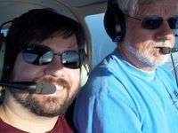
- Geoff
- Geoff's Dad
The Adventure
What's that saying about the best laid plans?
The night before, we had plotted out our course, created a flight path, and checked the weather advisory. All was good. The news had mentioned a front coming in that wouldn't affect anything, so we paid no mind to it. (For those of you wanting less subtlety, that's foreshadowing.)
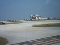
We got up, got showered, had breakfast and left by 7:00 with the sunrise, arriving at Albert Whitted in under an hour. It was there that we heard the real problem; while all reports had indicated this would be a perfectly clear day, it was IFR conditions, or Instrument Flight Rules, inland, meaning that visibility was bad enough that you needed a certain rating to fly solely by instruments. Dad has his IFR rating, but wasn't interested in flying in it today, which I can't blame him. The IFR conditions were supposed to dissipate by about 10:00 AM; rather than give up hope, we reversed our route in the hopes that we'd catch it mid-dissipation and continue onwards.
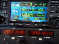
It took some dicking about, but we figured out the new GPS and specifically how to fly to coordinates. Onwards to the Port Charlotte graticule! We arrived with no other complaints and I took my pictures as best I could. The GPS was refreshing so quickly that the picture was as close as I could get to the moment. I also had my car's GPS with me, so I can figure out how to download the trip log, although I didn't have it on the entire time.
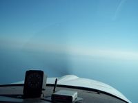
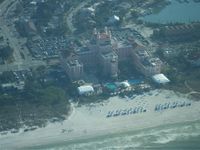
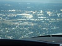
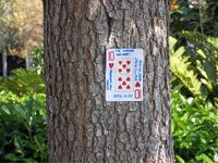
In Dad's words later, if the hashpoint were a mile further off shore, we wouldn't have gotten it. We were flying face-first into haze, and as demonstrated in the pictures below, looking towards the coast wasn't much better. We abandoned our flight plan and returned with at least one hash under our belts. I left the Ten of Hearts behind at the airport. On the drive, closer to 10:30, 11:00, we ended up looking skyward to find that the front was also enveloping St. Petersburg and the surrounding area, vindicating our decision to cut and run.
There's always Christmas; maybe we can try again another time.
Gallery
- Photo Gallery
Achievables
Geoff earned the Air geohash achievement
|

