Difference between revisions of "2013-02-20 -37 145"
imported>FippeBot m (Location) |
m (More specific location) |
||
| Line 67: | Line 67: | ||
<!--[[Category:Expeditions with photos]]--> | <!--[[Category:Expeditions with photos]]--> | ||
[[Category:Coordinates reached]] | [[Category:Coordinates reached]] | ||
| − | {{location|AU|VIC}} | + | {{location|AU|VIC|NI}} |
Latest revision as of 12:31, 1 August 2020
| Wed 20 Feb 2013 in -37,145: -37.6554927, 145.2887369 geohashing.info google osm bing/os kml crox |
Location
Near Sugarloaf reservoir
Participants
Planning
My plan was to get a double hash and a double imperial centurion bike ride in one day. I got this hash done fine but failed for the second hash. This was my planned route.
Expedition
I left my house at 11:10am with everything needed for the double hash ride, after the Gordon hash trip I did a few weeks ago I decided a few extra things were needed. I took enough food, staminade powder, a bike lock and a hivis vest as I would be riding a long way late at night. My first stop was only about 3km into the journey at Northcote Primary School where about 30 school kids were yelling at me. Their soccer ball had gone over the fence and across the road so I stopped to get it for them.
Other than map and bushfire checks my next stop was at the Kangaroo Ground Memorial Tower. I hadn't planned to stop here but it looked cool when I was riding past so I stopped to climb it. It was built in the '30s as a war memorial for WWI and has been used as a fire lookout since the '70s.
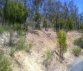
The hash point was in some trees just off Simspon road near Sugarloaf reservoir. As I turned into Simpson road I was greeted by a goat. I was excited to see a goat as I've been making a list of all the fauna I've encountered on my geohashes (only a mental list so far but I think I'll add it to my page). The goat was standing on a cliff on the side of the road which was probably about 60 degrees, (angle not temperature) although not far off as it was 30 degrees celsius and the ground would have been warmer.
A few hundred metres down Simpson road I could take my bike no further so I hid it in the bushes and continued on foot. It was steep grassy terrain with lots of reasonably small gum trees and a few roos hopping around. I made it the 200m from the road to the hash took my photos and headed back to the bike.
Breaking with my tradition of finding an easier route on the way back I climbed three barbed wire fences on the way back, I'm not quite sure how. I then set off on my expedition to the second geohash for the day.
Route
route for this expedition only http://goo.gl/maps/yEDg1 route for whole day plus 4k after the train http://goo.gl/maps/ebn4l


