Difference between revisions of "2016-04-01 52 1"
From Geohashing
imported>Sourcerer m (→New expedition) |
imported>FippeBot m (Location) |
||
| Line 46: | Line 46: | ||
[[Category:Expeditions with photos]] | [[Category:Expeditions with photos]] | ||
[[Category:Coordinates reached]] | [[Category:Coordinates reached]] | ||
| + | {{location|GB|ENG|NFK}} | ||
Latest revision as of 00:05, 16 August 2019
| Fri 1 Apr 2016 in Norwich, UK: 52.5822653, 1.1592834 geohashing.info google osm bing/os kml crox |
Location
A field near Kett's Oak, Norfolk, UK.
Participants
Plans
Expedition one of two spanning midnight - 2016-04-01 52 1 - 2016-04-02 52 1 - ETA 23:20.
Expedition
There was a handy lay-by to park. A field access track led towards derelict farm buildings. These were close to the busy A11 main road and are unlikely to be restored due to the traffic noise. The hashpoint was a few paces into the last field before the main road and easily reached.
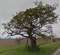
Kett's Oak is an actual oak tree of venerable age. Some of the older branches had been propped up to preserve them. There are good images on Google Street View.
Photos
Achievements
Expeditions and Plans
| 2016-04-01 | ||
|---|---|---|
| Mannheim, Germany | Q-Owl, DODO | A hashpoint near Grünstadt on the left side of the Rhine valley. |
| Norwich, United Kingdom | Sourcerer | A field near Kett's Oak, Norfolk, UK. |
Sourcerer's Expedition Links
2016-03-29 52 1 - 2016-04-01 52 1 - 2016-04-02 52 1 - KML file download of Sourcerer's expeditions for use with Google Earth.


