Difference between revisions of "2016-08-27 48 -123"
From Geohashing
imported>Wijnland (finish report) |
imported>Fippe m (fix) |
||
| Line 34: | Line 34: | ||
| latitude = 48 | | latitude = 48 | ||
| longitude = -123 | | longitude = -123 | ||
| − | | date = | + | | date = 2016-08-27 |
| name = [[User:Wijnland|Wijnland]] | | name = [[User:Wijnland|Wijnland]] | ||
| image = Wijnland_20160827_1534.jpg | | image = Wijnland_20160827_1534.jpg | ||
Revision as of 18:58, 11 August 2019
| Sat 27 Aug 2016 in 48,-123: 48.5311749, -123.3968392 geohashing.info google osm bing/os kml crox |

Location
On Elk Lake
Participants
Plans
padlle out get, get that waterhash
Expedition
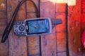
the paddle was quite a struggle because of the wind, but i made it. and it was nice and sunny!
Photos
Coordinates Reached

Achievements
Wijnland earned the Water geohash achievement
|