Difference between revisions of "2018-11-15 52 9"
m (Format) |
m (user categories) |
||
| Line 49: | Line 49: | ||
[[Category:Expeditions with photos]] | [[Category:Expeditions with photos]] | ||
{{location|DE|NI|H}} | {{location|DE|NI|H}} | ||
| − | + | {{user categories|user=Fippe|tram=14|train=23|foot=3|bus=27}} | |
Revision as of 23:57, 5 January 2022
| Thu 15 Nov 2018 in Hannover: 52.3729475, 9.9167899 geohashing.info google osm bing/os kml crox |
Location
This Geohash is located on a field in Ahlten.
Participants
Expedition
I was near Hannover's main train station today to listen to a talk, so I took the opportunity to go Geohashing afterwards.
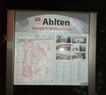
Ahlten is only 12 train-minutes away from there, and from Ahlten's train station it was a 20-minute walk to the Geohash.
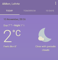
It was quite cold. According to Google, the temperature in Ahlten was "2°C, feels like 0°". Not a frozen Geohash yet. I wonder how Google measures how warm it feels.
I've been to Ahlten previously, to visit 2015-02-18 52 9. Back then I noticed that some of the streets have cool astronomical names, and this time the Geohash was right next to the best one, Saturnring. Other names include Marsstraße, Jupiterring, Neptunring, Plutoweg, Nordstern and Milchstraße. There also are the strangely-named Merkurring and Venusring. Nothing for Earth, Uranus or asteroids that aren't considered planets by Illinois politicians. The last time I was here it was around midnight, and today it is after dark too. It seems that I never see Ahlten by day, but at least I'm able to see stars here.
Like I wrote, the Geohash was located near Saturnring, on the field behind it to be precise. I located the coordinates and went back to the train station, from where I went back to Hannover.
Photos
Achievements
Fippe earned the Land geohash achievement
|
Fippe earned the Last man standing achievement
|


