Difference between revisions of "2016-07-03 56 36"
From Geohashing
(per Renaming Proposal) |
|||
| Line 45: | Line 45: | ||
{{Walk geohash | latitude = 56 | longitude = 36 | date = 2016-07-03 | name = [[User:Vb|vb]] }} | {{Walk geohash | latitude = 56 | longitude = 36 | date = 2016-07-03 | name = [[User:Vb|vb]] }} | ||
{{Easy_geohash | latitude = 56 | longitude = 36 | date = 2016-07-03 | name = [[User:Vb|vb]] }} | {{Easy_geohash | latitude = 56 | longitude = 36 | date = 2016-07-03 | name = [[User:Vb|vb]] }} | ||
| − | {{ | + | {{Graticule unlocked | latitude = 56 | longitude = 36 | date = 2016-07-03 | name = [[User:Vb|vb]] }} |
[[Category:Expeditions]] | [[Category:Expeditions]] | ||
| Line 53: | Line 53: | ||
[[Category:Land geohash achievement]] | [[Category:Land geohash achievement]] | ||
[[Category:Easy geohash]] | [[Category:Easy geohash]] | ||
| − | [[Category: | + | [[Category:Graticule unlocked achievement]] |
{{location|RU|MOS}} | {{location|RU|MOS}} | ||
Latest revision as of 03:06, 20 March 2024
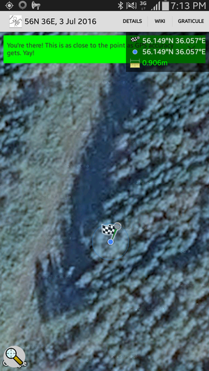
| Sun 3 Jul 2016 in 56,36: 56.1492068, 36.0573026 geohashing.info google osm bing/os kml crox |
Location
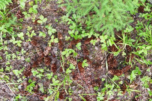
Not far away from Volokolamsk-Klin road, almost not in the woods.
Participants
Plans
On the way to my dacha I checked the geohash location, which I didn't do for quite a while. To my surprise, the hash was less than half a kilometer from the house - a lucky coincidence. So the plan was to do the hash, after getting to the dacha.
Expedition
The path seemed to be straightforward, and almost straight - which turned out not to be the case, the stream crossing on the straight path was missing. Nevertheless, the detour to the next crossing was no more than 200m.
Photos
Achievements
vb earned the Walk geohash Achievement
|
vb has visited an Easy Geohash
|
vb earned the Graticule Unlocked Achievement
|


