Difference between revisions of "2022-02-22 51 10"
(expedition report for Herzberg am Harz) |
m (Location) |
||
| Line 43: | Line 43: | ||
[[Category:Not reached - Mother Nature]] | [[Category:Not reached - Mother Nature]] | ||
| + | {{location|DE|NI|GÖ}} | ||
Latest revision as of 00:42, 27 February 2022
| Tue 22 Feb 2022 in 51,10: 51.6199612, 10.3483895 geohashing.info google osm bing/os kml crox |
Location
The hash lay in the Pöhlder Wald.
Participants
Plans
Today's date was in German form 22.02.2022 which is a palindrome. That was a reason for me for an expedition. The best reachable geohash was this one in the Pöhlder Wald.
Expedition
I traveled by train and by bus to Pöhlde. Then I walked through the fields to the forest. Then into the forest. And I found the hash to be in a sinkhole. But I couldn't make to reach the hash. Maybe I was there, but I don't have a proof. From the nearby path the GPSr told me 40 meters to the hash, at the nearest place the GPSr told me 30 meters to the hash, but I was 40 steps away from the path.
Tracklog
The green line means 40 meters.
Photos
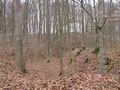
the sinkhole „Schwarze Kuhle“
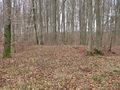
the GPSr showed 40 meters from here, behind the branch
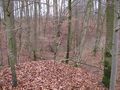
the GPSr showed 30 meters from here, 40 steps away from the path
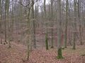
looking from northeast, 65 meters to the hash


