Difference between revisions of "2022-03-11 40 -4"
(→Expedition) |
(→Tracklog) |
||
| Line 105: | Line 105: | ||
area to the Tibetan Bells and the walks on both ends. | area to the Tibetan Bells and the walks on both ends. | ||
| − | |||
[[Category:Expeditions]] | [[Category:Expeditions]] | ||
[[Category:Expeditions with photos]] | [[Category:Expeditions with photos]] | ||
[[Category:Coordinates reached]] | [[Category:Coordinates reached]] | ||
Revision as of 17:30, 12 March 2022
| Fri 11 Mar 2022 in 40,-4: 40.2343601, -4.6326822 geohashing.info google osm bing/os kml crox |
Location
On a (fenced) meadow near Fresnedilla.
Participants
Plans
It was a rainy day, so I did not really feel tempted to go on a motorcycle expedition. However, the geohash was not too far — an about 50 minutes ride — and it seemed to be easily accessible, just a 500 meters walk along a path. Moreover, just a few kilometers away, there was something on the Maps annotated “Campanas Tibetanas” (Tibetan Bells). This sounded worth an inspection.
Because of the rain to be expected, I did not take the old Goldwing but die Krähe, already used in expeditions 2021-08-18_40_-3 and 2021-07-16_40_-4, which provides better protection. The biggest problem when riding on two wheels through the rain is actually not getting wet (you can dress up for that), but the impaired vision due to raindrops on the outside and fog on the inside of the visor. Die Krähe with her windshield wiper provides much more sense of security.
Expedition
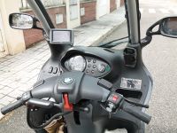
It was the first time that I mounted the navigation device on this bike, using the car windscreen mount. On the backside of a compartment in the dashboard, there is a cigarette lighter plug, so, all set.
There was a little bit of rain on the outbound ride, but it ceased before I arrived, so I could walk around and take photos without respective hassel.
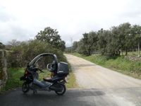
The paved road ended at the parking space of a senior residence. I parked the bike there and followed on foot the unpaved continuation towards the geohash.
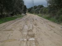
The recent rain had left its marks, but still it was an easy walk along the path.
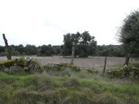
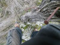
After about 500 meters, I reached the point on the path closest to the geohash. It was located just 50 meters behind this fence. The fence was not very high, and the rock in the center of the photo could serve as stepping stone.
I could indeed easily step over the fence without damaging anything.
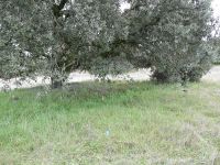
Here it is, just beside a tree.
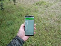
The mobile on the ground marks the location. There's just grass and weed here, so no precious crops which could be damaged. Nevertheless, I left quickly to avoid any persistent questions and also being curious to explore the Tibetan Bells.
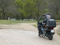
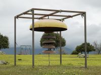
After a short ride of a few kilometers (also included in the tracklog), I parked close to one of the frequent public picnic places. From there, I could already see something curious, and I walked up to it.
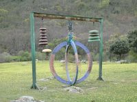
And indeed, there was an arrangement of bells, with nicely matched tunes. When knocked, they emit quite a meditative sound. In the background of the photo, another strucutre is visible.
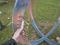
The strange thing in the center is in fact also a type of bell. First, I also simply knocked it, but then I found another way to make it sound.
Rattling with some stick over the rods creates a very special noise.
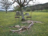
There are a couple of other curious objects around, for example this “debating place.”
So, it is an interesting place which could probably unfold even more charm if the weather was nicer. On the way home, I encountered substantial rain, so I was quite happy riding die Krähe with roof and windshield wiper.
Tracklog
This shows the ride from the geohash area to the Tibetan Bells and the walks on both ends.
