Difference between revisions of "2022-08-16 52 9"
(expedition report for Schwarmstedt-Essel) |
m (Location) |
||
| Line 66: | Line 66: | ||
[[Category:Coordinates reached]] | [[Category:Coordinates reached]] | ||
| + | {{location|DE|NI|HK}} | ||
Revision as of 12:42, 17 August 2022
| Tue 16 Aug 2022 in 52,9: 52.6895150, 9.6344038 geohashing.info google osm bing/os kml crox |
Location
The hash lay on a field at the Schwarmstedter Straße in Essel.
Participants
Plans
GeorgDerReisende
The plan was to travel by train to Schwarmstedt and by bus to Essel, walking around Essel, then to the hash.
Expedition
GeorgDerReisende
The train to Schwarmstedt was late and the bus was gone. I continued to Hodenhagen and took the bus from there. After a walk throug Essel I arrived at the hashfield. In the second train I noticed that I had forgotten my planning sheet. The only thing I knew, that the today's hash was 347 away from the 2021-04-11 52 9 hash and two meters in the field. So I walked along the Schwarmstedter Straße until I had a 352 distance to the older hash. I went onto the field, danced around, found a noticable place and declared my place as the hash. Later at home I noted, that I was there. My declaration seemed to be ten meters west, but my whole track had a shift of some meters to the west and I was on the field and not in the ditch.

|
Tracklog
GeorgDerReisende
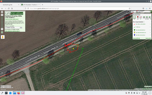
The short line is the distance between the old hash and the today's hash.
Photos
GeorgDerReisende
352 meters to 2021-04-11 52 9, the hash must be on this line
nearly view from 2021-04-11 52 9 to 2022-08-16 52 9


