Difference between revisions of "Globalhash"
imported>Starbird (→Locations: deprecating the drwilco calculator) |
imported>Starbird (→Locations: drwilco tool fixed?) |
||
| Line 25: | Line 25: | ||
*Hashpoint lists or overview maps requested with the [[User:Ekorren/Hash_Inquiry_Tool|Small Hash Inquiry Tool]] always include the globalhash of today and upcoming dates as available. | *Hashpoint lists or overview maps requested with the [[User:Ekorren/Hash_Inquiry_Tool|Small Hash Inquiry Tool]] always include the globalhash of today and upcoming dates as available. | ||
* DAGAAG ([[User:Danatar|Danatar]]'s [http://wiki.xkcd.com/geohashing/Image:Globalhash-at-a-glance.png Approximate-Globalhash-At-A-Glance manual lookup map]): If the online tool doesn't work and you want to avoid difficult calculations, just have a quick glance at the approximate location. Take the W30-adjusted coordinate offset (e.g. from the peeron map, but don't use American graticules) and compare it with the map using the black grid lines. If this gives a location at the other end of the world, you don't have to think about it any more, but if it is near you, you will have to use a calculator to get the exact location. [http://wiki.xkcd.com/geohashing/Image:Globalhash-at-a-glance-example.png See example here] (for 2008-09-10 like in the other example above). | * DAGAAG ([[User:Danatar|Danatar]]'s [http://wiki.xkcd.com/geohashing/Image:Globalhash-at-a-glance.png Approximate-Globalhash-At-A-Glance manual lookup map]): If the online tool doesn't work and you want to avoid difficult calculations, just have a quick glance at the approximate location. Take the W30-adjusted coordinate offset (e.g. from the peeron map, but don't use American graticules) and compare it with the map using the black grid lines. If this gives a location at the other end of the world, you don't have to think about it any more, but if it is near you, you will have to use a calculator to get the exact location. [http://wiki.xkcd.com/geohashing/Image:Globalhash-at-a-glance-example.png See example here] (for 2008-09-10 like in the other example above). | ||
| − | *The | + | *The [http://www.drwilco.net/globalhash/map.html Online Globalhashing Tool] appears to be working properly again. <!-- The way it acquires the Dow opening appears to have broken on May 8, 2009, so global hashpoints for all dates since then are incorrect.--> Look up any date since 1928-10-01. Please note that this tool is known to frequently give wrong locations after the DJIA was announced. It usually switches to the correct locations after a few minutes but that may also take several hours. |
== Winners == | == Winners == | ||
Revision as of 17:51, 9 October 2009
The decimals generated by the geohashing algorithm can also be used to generate a single point on the globe instead of one for each graticule and this award celebrates those lucky or mad enough to pursue that single point.
To generate this point take W30 decimals for a date (to make it global) and multiply the latitude by 180 and subtract 90, and the longitude by 360 subtracting 180. This will generate a single point on the globe which is today's only globalhash.
Proof is the same as any hash, but at the single day's coordinates. Good luck! The odds of the globalhash falling in your graticule are 1 in 64,800!
52.672631906558,-30.033195971213
Example
For 10 September 2008, the W30 decimals generated were 0.2642955149758937 and 0.45661491254372155 for latitude and longitude respectively.
0.26429551497589370 * 180 =  47.5731926957 -  90 = -42.4268073043° Latitude
0.45661491254372155 * 360 = 164.3813685160 - 180 = -15.6186314840° Longitude
Or 42.4268073043° S, 15.6186314840° W which is in the south Atlantic Ocean, near Gough Island.
Locations
- KML ¦ Google Maps - all globalhashes, beginning 2008-05-26 until 2008-09-08.
- Hashpoint lists or overview maps requested with the Small Hash Inquiry Tool always include the globalhash of today and upcoming dates as available.
- DAGAAG (Danatar's Approximate-Globalhash-At-A-Glance manual lookup map): If the online tool doesn't work and you want to avoid difficult calculations, just have a quick glance at the approximate location. Take the W30-adjusted coordinate offset (e.g. from the peeron map, but don't use American graticules) and compare it with the map using the black grid lines. If this gives a location at the other end of the world, you don't have to think about it any more, but if it is near you, you will have to use a calculator to get the exact location. See example here (for 2008-09-10 like in the other example above).
- The Online Globalhashing Tool appears to be working properly again. Look up any date since 1928-10-01. Please note that this tool is known to frequently give wrong locations after the DJIA was announced. It usually switches to the correct locations after a few minutes but that may also take several hours.
Winners
The following Geohashers have won this award, and have supplied proof.
None so far. Be the first!
Honorable mentions
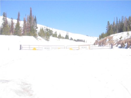
- David Souther made it within 8 miles of the 2009-03-04 globalhash before Mother Nature turned him back.
Ribbon Template
This user earned the Globalhash achievement
|
