Difference between revisions of "2008-09-11 49 -123"
imported>Thomcat (Success/failure category added) |
imported>Benjw m (→Expedition: typo) |
||
| Line 45: | Line 45: | ||
</gallery> | </gallery> | ||
| − | Sadly, I knew from online conversation that the most likely other attendees were in class, although it was a nice alley, it still wasn't a very good spot for a picnic, so I didn't stay much longer | + | Sadly, I knew from online conversation that the most likely other attendees were in class, although it was a nice alley, it still wasn't a very good spot for a picnic, so I didn't stay much longer than thepiguy. The sun was setting in my eyes as I turned to go, and I still had a valid transfer, so I took the bus most of the way home. |
I think this is the first time ever that I haven't had to create a page to document a geohash I have visited. But I have still never been to a geohash that had any evidence at the site that another geohasher had been there. (Just to rub it in for thepiguy: buy some sidewalk chalk, eh?) | I think this is the first time ever that I haven't had to create a page to document a geohash I have visited. But I have still never been to a geohash that had any evidence at the site that another geohasher had been there. (Just to rub it in for thepiguy: buy some sidewalk chalk, eh?) | ||
Revision as of 14:48, 1 March 2009
| Thu 11 Sep 2008 in 49,-123: 49.2307967, -123.0609883 geohashing.info google osm bing/os kml crox |
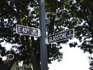
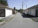
Todays geohash location is in a back alley on Gladstone between 43rd and 44th.
Geohashers
thepiguy
Expedition
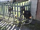
Thepiguy's expedition started at Mountain Equipment Coop, on Broadway. Me and my bike had been dropped off at MEC so I could get a few things before school. After spending another thwack of money on some more biking things (man that stuff is expensive!) I started my trip.
I started out on the 10th ave. bike route and took a right on Ontario. From there I switched to the 37th bike route until I got to Gladstone. As it turned out, there's no crosswalk at 41st and Gladstone, so all I could do was just run really fast, and hope that the semi-trucks had good brakes.
As promised by google, the location was in a back alley between the houses on 43rd and 44th. There were a few residents milling around at the other end of the alley, but besides them it was pretty deserted.
I only spent around 5 minutes at the hash (it seems each geohash I go to, it takes less and less time) and didn't have anything to leave as a marker.
I took the 37th bike route to UBC and even made it in time for my 14:00 class! (To make up for that though, I'm updating the wiki from class.)
Images
Robyn
Expedition
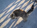
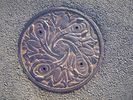
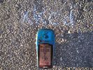
This geohash was within striking distance of the Couch Potato for me, only two and a half kilometres from my house, so I decided to make it a Walk Geohash. The only question was, how to document a walk? I decided to take a picture about every five minutes as I strolled along. I would have put the GPS down next to each subject, but it took fifteen minutes to locate enough satellites to report a position. I hope that's because of the scheduled outages of satellites seven and twenty-five, and not the unscheduled life end of my GPS unit. Geohashing was a fun way to cast excitement into a simple walk, especially as I knew from thepiguy that it was accessible, and that I was not going to have to wade through swamps, climb over half-burned trees or be almost thwarted by beavers. Here is my story.
Sadly, I knew from online conversation that the most likely other attendees were in class, although it was a nice alley, it still wasn't a very good spot for a picnic, so I didn't stay much longer than thepiguy. The sun was setting in my eyes as I turned to go, and I still had a valid transfer, so I took the bus most of the way home.
I think this is the first time ever that I haven't had to create a page to document a geohash I have visited. But I have still never been to a geohash that had any evidence at the site that another geohasher had been there. (Just to rub it in for thepiguy: buy some sidewalk chalk, eh?)
