Difference between revisions of "2008-11-20 50 10"
imported>Danatar (New page: m0000ltihash! I've got a looooong story to write. Danatar) |
imported>Danatar |
||
| Line 1: | Line 1: | ||
| − | + | {{meetup graticule | |
| + | | map=<map lat="50" lon="10" date="2008-11-20" /> | ||
| + | | lat=50 | ||
| + | | lon=10 | ||
| + | | date=2008-11-20 | ||
| + | | graticule_name=Gotha | ||
| + | | graticule_link=Gotha, Germany | ||
| + | }}__NOTOC__ | ||
| + | == Location == | ||
| + | Today's location is in a forest near Altershausen and Sechsthal. | ||
| + | |||
| + | |||
| + | == Expedition ([[User:Danatar|Danatar]])== | ||
| + | I took the train from Würzburg to Haßfurt, then went in darkness by bike to the hashpoint. | ||
| + | |||
| + | The full report is on the [[2008-11-20 50 9]] page, chapter 4 of the story. | ||
| + | |||
| + | |||
| + | It's the second part of a multihash. I cycled about 2*1.2 km (home - Würzburg train station) + 2* 8.9 km (Haßfurt train station - hashpoint) = 20.2 km. My odometer says 0.006 km total distance, but I tend to believe Google Maps on this one. It's a new graticule for me, so the Minesweeper goes LEVELUP! to 4. | ||
| + | |||
| + | {{Multihash2 | count = 2 | date = 2008-11-20 | name = Danatar}} | ||
| + | |||
| + | <gallery> | ||
| + | Image:2008-11-20 50 10 hassfurtbhf.jpg|Ha[[wikipedia:ß|ß]]furt train station | ||
| + | Image:2008-11-20 50 10 sechsthal.jpg|Sechsthal town sign (it's tempting to translate the name's phonetics (Sextal) as "valley of sex", but my first and only impression of the town does not fit well with that) | ||
| + | Image:2008-11-20 50 10 waldrand.jpg|Picture taken at the edge of the trees near the hashpoint, 50.0578 10.6037. No the original brightness ;-) | ||
| + | Image:2008-11-20 50 10 hp.jpg|Coordinates reached (near enough) | ||
| + | </gallery> | ||
| + | |||
| + | [[Category:Expeditions]] | ||
| + | [[Category:Expeditions with photos]] | ||
| + | [[Category:Expedition without GPS]] | ||
| + | [[Category:Coordinates reached]] | ||
| + | [[Category:Danatar]] | ||
Revision as of 01:54, 21 November 2008
| Thu 20 Nov 2008 in Gotha: 50.0567020, 10.6033959 geohashing.info google osm bing/os kml crox |
Location
Today's location is in a forest near Altershausen and Sechsthal.
Expedition (Danatar)
I took the train from Würzburg to Haßfurt, then went in darkness by bike to the hashpoint.
The full report is on the 2008-11-20 50 9 page, chapter 4 of the story.
It's the second part of a multihash. I cycled about 2*1.2 km (home - Würzburg train station) + 2* 8.9 km (Haßfurt train station - hashpoint) = 20.2 km. My odometer says 0.006 km total distance, but I tend to believe Google Maps on this one. It's a new graticule for me, so the Minesweeper goes LEVELUP! to 4.
Danatar earned the Multihash Achievement
|
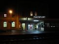
Haßfurt train station
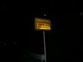
Sechsthal town sign (it's tempting to translate the name's phonetics (Sextal) as "valley of sex", but my first and only impression of the town does not fit well with that)
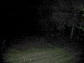
Picture taken at the edge of the trees near the hashpoint, 50.0578 10.6037. No the original brightness ;-)
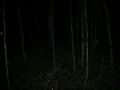
Coordinates reached (near enough)


