Difference between revisions of "Manukau City, New Zealand"
From Geohashing
imported>TunezNZ |
imported>TunezNZ (→Photo Gallery: some images finaly) |
||
| Line 26: | Line 26: | ||
==Photo Gallery== | ==Photo Gallery== | ||
| − | + | <gallery widths="160px" align=center> | |
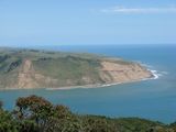
| + | Image:2009 01 05 -37 174 westpan.jpg|Pan from West lookout over the hash | ||
| + | Image:2009 01 05 -37 174 Heads1.JPG|The south clifs of the manakau heads | ||
| + | </gallery> | ||
==Locals== | ==Locals== | ||
Revision as of 09:32, 5 January 2009
| Glinks Gully | Auckland | Coromandel |
| – | Manukau City, New Zealand | Hamilton |
| – | Waitara | South Waikato |
[[Category:Meetup in {{{lat}}} {{{lon}}}| ]]
Today's Location: Manukau City, NZ
The Manukau City graticule is located at latitude -37, longitude 174.
Stuff goes here about Manukau City
Contents
Geohashes
2008-12-16 -37 174: User:AMADANON Inc. went on an expedition and claimed Virgin Graticule
2009-01-05 -37 174: User:TunezNZ along with jonootto managed to get to the hash in good time.
