Difference between revisions of "Coos Bay, Oregon"
From Geohashing
imported>Michael5000 |
imported>Michael5000 |
||
| Line 13: | Line 13: | ||
}} | }} | ||
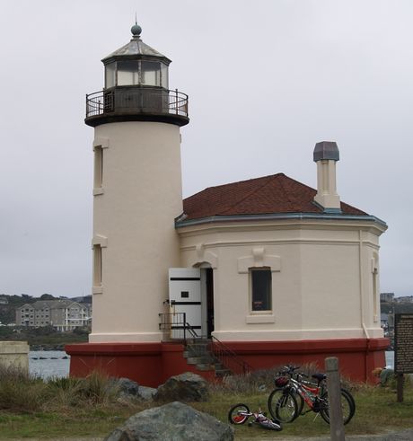
| − | [[Image: | + | [[Image:Bandon Lighthouse.jpg|460px|[[Coos County's iconic Coquille River Lighthouse, north of Bandon in Bullards Beach State Park.]]]] |
The {{PAGENAME}} [[graticule]] is located around [http://irc.peeron.com/xkcd/map/map.html?lat=43&long=-124 latitude 43, longitude -124]. Roughly 3/4 of this graticule is covered by the Pacific Ocean. Major coastal towns include Coos Bay, North Bend, Reedsport, Florence, Bandon and the county seat, Coquille. | The {{PAGENAME}} [[graticule]] is located around [http://irc.peeron.com/xkcd/map/map.html?lat=43&long=-124 latitude 43, longitude -124]. Roughly 3/4 of this graticule is covered by the Pacific Ocean. Major coastal towns include Coos Bay, North Bend, Reedsport, Florence, Bandon and the county seat, Coquille. | ||
Revision as of 04:41, 1 January 2010
| 44,-125 | Newport | Eugene |
| 43,-125 | Coos Bay | Roseburg |
| 42,-125 | Brookings | Grants Pass |
|
Today's location: geohashing.info google osm bing/os kml crox | ||
The Coos Bay, Oregon graticule is located around latitude 43, longitude -124. Roughly 3/4 of this graticule is covered by the Pacific Ocean. Major coastal towns include Coos Bay, North Bend, Reedsport, Florence, Bandon and the county seat, Coquille.
Expedition History
This is a virgin graticule. If you have a successful expedition, award yourself the Virgin Graticule achievement, and please record the graticule's deflowered state here and on the Oregon page.
2009-12-25 43 -124 North of Myrtle Point off of Sitkum Lane
Michael5000 and Mrs.5000 in an Expedition Thwarted by private land and an impassable gully.
Local Geohashers
popop (Living in Coos Bay)
