Difference between revisions of "2009-04-20 67 19"
From Geohashing
imported>The ru m |
imported>The ru m |
||
| Line 33: | Line 33: | ||
Image:2009-04-20_67_19_gps.jpg | GPS @ the hashpoint | Image:2009-04-20_67_19_gps.jpg | GPS @ the hashpoint | ||
Image:2009-04-20_67_19_the_ru.jpg | the ru @ the hashpoint | Image:2009-04-20_67_19_the_ru.jpg | the ru @ the hashpoint | ||
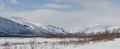
| − | Image:2009-04-20_67_19_kebne.jpg | | + | Image:2009-04-20_67_19_kebne.jpg | [http://en.wikipedia.org/wiki/Kebnekaise Kebnekaise], the tallest mountain in Sweden (on the right) |
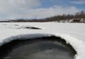
Image:2009-04-20_67_19_water.jpg | | Image:2009-04-20_67_19_water.jpg | | ||
Image:2009-04-20_67_19_power.jpg | Do we need a <nowiki>[[Category:Expeditions with powerlines]]</nowiki>? | Image:2009-04-20_67_19_power.jpg | Do we need a <nowiki>[[Category:Expeditions with powerlines]]</nowiki>? | ||
Revision as of 16:30, 20 April 2009
| Mon 20 Apr 2009 in 67,19: 67.8570420, 19.2894693 geohashing.info google osm bing/os kml crox |
The hashpoint was on (the frozen) Paittasjärvi, near Pirttivuopio.
the ru
Great day for geohashing. I brought skis, but the snow was hard enough to walk on.
This was the second expedition this day, the first being our midnight circus geohash.
the ru achieved level 4 of the Minesweeper Geohash achievement
|
the ru earned the Multihash Achievement
|
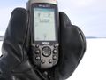
GPS @ the hashpoint
- 2009-04-20 67 19 the ru.jpg
the ru @ the hashpoint
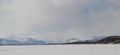
Kebnekaise, the tallest mountain in Sweden (on the right)
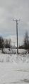
Do we need a [[Category:Expeditions with powerlines]]?
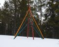
Art (?) near Puoltsa
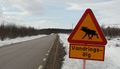
The sign (also near Puoltsa) warns about a "wandering moose", which was nowhere to be seen
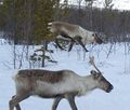
Reindeers seen from the car
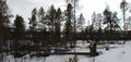
What has happened to these poor trees? :-(
The Vistas valley, north of Kebnekaise
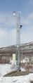
A weather station (I assume?) near Nikkaluokta


