Difference between revisions of "2010-03-20 52 13"
imported>Davidc (writeup and photos) |
imported>FippeBot m (Location) |
||
| Line 45: | Line 45: | ||
[[Category:Expeditions with photos]] | [[Category:Expeditions with photos]] | ||
[[Category:Coordinates reached]] | [[Category:Coordinates reached]] | ||
| + | {{location|DE|BE}} | ||
Latest revision as of 01:16, 9 August 2019
| Sat 20 Mar 2010 in 52,13: 52.5666126, 13.3418089 geohashing.info google osm bing/os kml crox |
Location
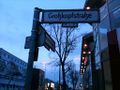
Car park at the corner of a graveyard in Reinickendorf. Quite close to an expedition last year.
Participants
Plans
- davidc plans to be there if it's not too miserable. 3pm?
Expedition
I arrived at the hashpoint at 17:45 after trying unsuccessfully to find a nearby geocache. The coordinates were on the pavement next to a carpark for the graveyard, on the easterly flightpath to nearby Tegel airport. I didn't leave a poster as it was rather too public and manky.
Nothing particularly interesting about this one. After the hash I headed through the graveyard in the vague direction of some geocaches, but was foiled by the fact that it was three separate graveyards in a huge complex and you couldn't walk through. I picked up two caches but the third, on the roof of the shopping mall (from which I took the photo of the plane landing at Tegel) was unreachable due to the fact that there was a pervert loitering at the coordinates in the otherwise empty carpark for at least an hour and a half.
Photos
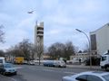
Observation platform just before the hashpoint.
Carpark. Woman is on the hashpoint.
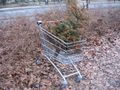
Hash cart.
Success!
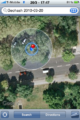
iPhone map proof
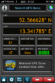
iPhone GPS proof
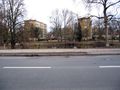
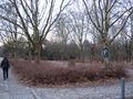
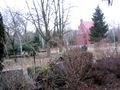
Pond across the road.
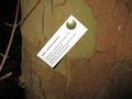
Hash card.

Graveyard entrance.
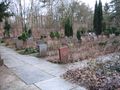
Part of the enormous graveyard complex.
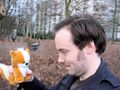
Tee hee hee.
The three adjacent graveyards mistrust each other so much they have fences in between.
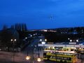
Plane landing at TXL.


