Difference between revisions of "2011-03-20"
From Geohashing
imported>AperfectBot m (Ook.) |
imported>Jiml m (Fix gallery style) |
||
| Line 1: | Line 1: | ||
<noinclude>{{date navigation}}</noinclude> | <noinclude>{{date navigation}}</noinclude> | ||
{{auto coordinates|2011-03-20}} | {{auto coordinates|2011-03-20}} | ||
| − | {{auto | + | {{auto gallery2|2011-03-20}} |
<noinclude>{{expedition summaries|2011-03-20}}</noinclude> | <noinclude>{{expedition summaries|2011-03-20}}</noinclude> | ||
Latest revision as of 13:56, 7 April 2011
Expedition Archives from March 2011
Saturday 19 March 2011 | Sunday 20 March 2011 | Monday 21 March 2011
See also: Category:Meetup on 2011-03-20
Coordinates
All locations: .3877725, .6268758
Globalhash:
-20.200958409555,45.675286643480
Photo Gallery
Expeditions and Plans
| 2011-03-20 | ||
|---|---|---|
| Varna, Bulgaria | Kisolre | In a ex corn field near Voivodino village. |
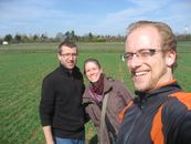
| Mannheim, Germany | ilpadre, fivetonsofflax, Euterkuh, Mampfred, LadyBB | In a field south of Eppelheim. |
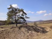
| Schweinfurt, Germany | Reinhard | On a field at the foot of the "Großen Gleichberg" (big equal mountain). |
| Halle (Saale), Germany | Rincewind, Yakamoz | For a change, the hashpoint was on a field near Querfurt. |
| Northampton, United Kingdom | Sourcerer | Multihash 3 of 5. In a field at Twywell Hills and Dales, about 4.5 miles ea... |
| Birmingham, United Kingdom | Sourcerer | Multihash 2 of 5. In a field about five miles west of Coventry, UK. 2011-03-20 53 -1 ::2011-03-20 52 -1 ::... |
| Cambridge, United Kingdom | Sourcerer | Multihash 4 of 5. In a field about a mile west of the Elveden Center Parcs ... |
| Norwich, United Kingdom | Sourcerer | Multihash 5 of 5. In a field north west of Frostenden, two miles west of Wr... |
| Sheffield, United Kingdom | Sourcerer | Multihash 1 of 5. In a field north of the A57 at Hollow Meadows about seven... |
| Vantaa, Finland | small oaks | The coordinates were in a private yard roughly 50 m off the spot I managed ... |


