Difference between revisions of "2012-02-28 45 -122"
imported>Michael5000 m (→Photos) |
imported>Michael5000 m (→Photos) |
||
| Line 49: | Line 49: | ||
== Photos == | == Photos == | ||
| − | |||
| − | |||
| − | |||
| − | |||
<gallery perrow="5"> | <gallery perrow="5"> | ||
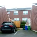
| + | File:2012-02-28 45 -122 interior.JPG|the inside of a block of townhouses... | ||
| + | File:2012-02-28 45 -122 hashpoint.JPG|the exact hashpoint is just inside that newly built patio fence. | ||
| + | File:2012-02-28 45 -122 front.JPG|if you lived here, you could have been a patio potato.... | ||
</gallery> | </gallery> | ||
Revision as of 19:17, 2 March 2012
| Tue 28 Feb 2012 in 45,-122: 45.5501603, -122.5016204 geohashing.info google osm bing/os kml crox |
Location
Among a block of townhouses off of Sandy Boulevard.
Participants
Plans
Not too much planning - it was sort of nearby for both of us, so we went.
Heaven forbid if we actually got there at the same time. Ever.
Expedition
M5k
Not a particularly interesting location, except in the sense that any random location is interesting, this hashpoint had the significant advantage of being a few miles from work. The actual hashpoint is in the interior of a suburban block of townhouses, on someone's enclosed backdoor patio. It wasn't one that you could visit precisely without being a pest, if even then. I got within a few dozen feet in the parking area, took a few pictures, declared victory, and continued on my way.
Jim
I had something on the way to Portland in the early evening, and afterwards headed by the store, and then to the hashpoint. It got a little exciting when I thought I was there based on the maps, but the GPS still said a number of miles.
I finally found a lost digit in the entered hashpoing coords in the GPS, and I was on my way to the final few hundred feet. I started on the wrong side of the building, but ended up inside. It was dark and the middle of the Condo complex, so I figured I wouldn't stick around or take any photos.
I headed for home.
Photos
Achievements
- Land Geohash


