Difference between revisions of "2012-03-13 50 11"
imported>Paintedhell (Expedition planned.) |
imported>Paintedhell |
||
| Line 12: | Line 12: | ||
[[User:Reinhard|Reinhard]] and [[User:Paintedhell|Juja]] both signalled readiness to give it a try and test their newest feet-in-plastic-bags-technologies, but since they don't seem to be able to synchronize their schedules any more there even might be two (or more? Hello, 50/11 hashers?) expeditions. | [[User:Reinhard|Reinhard]] and [[User:Paintedhell|Juja]] both signalled readiness to give it a try and test their newest feet-in-plastic-bags-technologies, but since they don't seem to be able to synchronize their schedules any more there even might be two (or more? Hello, 50/11 hashers?) expeditions. | ||
| − | [[Category: | + | == Expedition: Juja == |
| + | I started after work with dark clouds as far as the eye could see, but no rain. I did not feel too fast and indeed an old man on an even older bike overtook me at the first hill. But eventually I arrived at Milda and it went downhill from there ;) - I knew the way to Rodias and instead of playing the chicken on the vegetable patch I just let the plastic bags be and cycled directly over the dirty field all the way to the point which would have had a lovely view to Leuchtenburg if the sun had been shining. When I was back on the roads of Rodias my tyres were full of dirt and mud, and so the following descent to Altendorf at 60-something km/h was great fun - dirt all over my face, yay! Anyway: hashpoint reached. | ||
| + | |||
| + | == Photos: Juja == | ||
| + | {{gallery|width=200|height=200|lines=2 | ||
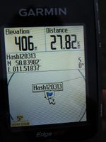
| + | |Image:120313_50_11_1.jpg|Proof of coordinates. | ||
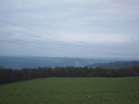
| + | |Image:120313_50_11_2.jpg|Lovely dusk+bad weather view to Leuchtenburg. | ||
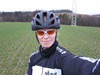
| + | |Image:120313_50_11_3.jpg|Stupidly grinning Geohasher at the point. | ||
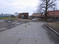
| + | |Image:120313_50_11_4.jpg|Marked the way to the hash. | ||
| + | }} | ||
| + | |||
| + | [[Category:Expeditions]] | ||
| + | [[Category:Expeditions with photos]] | ||
| + | [[Category:Coordinates reached]] | ||
Revision as of 20:31, 13 March 2012
| Tue 13 Mar 2012 in 50,11: 50.8398222, 11.5183660 geohashing.info google osm bing/os kml crox |
Location
200 meters into a probably very dirty field near Rodias. Great climb, great descent and muddy feet are expected for all participants.
Plans
Reinhard and Juja both signalled readiness to give it a try and test their newest feet-in-plastic-bags-technologies, but since they don't seem to be able to synchronize their schedules any more there even might be two (or more? Hello, 50/11 hashers?) expeditions.
Expedition: Juja
I started after work with dark clouds as far as the eye could see, but no rain. I did not feel too fast and indeed an old man on an even older bike overtook me at the first hill. But eventually I arrived at Milda and it went downhill from there ;) - I knew the way to Rodias and instead of playing the chicken on the vegetable patch I just let the plastic bags be and cycled directly over the dirty field all the way to the point which would have had a lovely view to Leuchtenburg if the sun had been shining. When I was back on the roads of Rodias my tyres were full of dirt and mud, and so the following descent to Altendorf at 60-something km/h was great fun - dirt all over my face, yay! Anyway: hashpoint reached.
Photos: Juja
|


