Difference between revisions of "2012-05-13 50 11"
From Geohashing
imported>Paintedhell (Created page with "{{meetup graticule | lat=50 | lon=11 | date=2012-05-13 }} <!-- edit as necessary --> __NOTOC__ == Location == In the middle of the forest near Tannroda. == Participants == * [...") |
imported>Paintedhell |
||
| Line 14: | Line 14: | ||
== Expedition == | == Expedition == | ||
| − | I visited the point on my way from my parents back to Jena (by bike, 97 km altogether). | + | I visited the point on my way from my parents' home back to Jena (by bike, 97 km altogether). |
| + | |||
| + | Geohashing today meant only a tiny change of route and a detour of maybe 2 or 3 kms, so it would have been mad not to go there. I arrived around 7 pm and was surprised to see a guy with a mountainbike some 50 meters ahead of me on the same godforsaken path in that not-so-lovely forest. Another Geohasher? He continued towards the point, but I couldn't catch up (being slightly handicapped going completely offroad on my roadbike) and obviously he also passed the point by 10 meters maximum, but he did not stop there - veeery strange... | ||
== Photos == | == Photos == | ||
{{gallery|width=200|height=200|lines=2 | {{gallery|width=200|height=200|lines=2 | ||
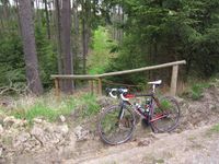
| − | + | |Image:120513_50_11_1.jpg|Thank god there's something like a way going down there. | |
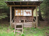
| + | |Image:120513_50_11_2.jpg|Shooting stand near the point. | ||
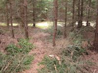
| + | |Image:120513_50_11_3.jpg|The lovely view from the Geohash point. | ||
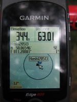
| + | |Image:120513_50_11_4.jpg|Proof of location. | ||
}} | }} | ||
[[Category:Expeditions]] | [[Category:Expeditions]] | ||
| − | + | [[Category:Expeditions with photos]] | |
[[Category:Coordinates reached]] | [[Category:Coordinates reached]] | ||
Revision as of 07:01, 14 May 2012
| Sun 13 May 2012 in 50,11: 50.8654550, 11.2888676 geohashing.info google osm bing/os kml crox |
Location
In the middle of the forest near Tannroda.
Participants
Expedition
I visited the point on my way from my parents' home back to Jena (by bike, 97 km altogether).
Geohashing today meant only a tiny change of route and a detour of maybe 2 or 3 kms, so it would have been mad not to go there. I arrived around 7 pm and was surprised to see a guy with a mountainbike some 50 meters ahead of me on the same godforsaken path in that not-so-lovely forest. Another Geohasher? He continued towards the point, but I couldn't catch up (being slightly handicapped going completely offroad on my roadbike) and obviously he also passed the point by 10 meters maximum, but he did not stop there - veeery strange...
Photos
|


