Difference between revisions of "2012-07-01 45 -122"
imported>Michael5000 (→Expedition) |
imported>Michael5000 |
||
| Line 1: | Line 1: | ||
| − | |||
<!-- If you did not specify these parameters in the template, please substitute appropriate values for IMAGE, LAT, LON, and DATE (YYYY-MM-DD format) | <!-- If you did not specify these parameters in the template, please substitute appropriate values for IMAGE, LAT, LON, and DATE (YYYY-MM-DD format) | ||
| Line 36: | Line 35: | ||
I decided that I was "here" enough. | I decided that I was "here" enough. | ||
| − | |||
| − | |||
| − | |||
== Photos == | == Photos == | ||
| Line 53: | Line 49: | ||
| − | |||
| − | |||
| − | |||
| − | |||
| − | |||
| − | |||
| − | |||
| − | |||
| − | |||
| − | |||
[[Category:Expeditions]] | [[Category:Expeditions]] | ||
| − | |||
[[Category:Expeditions with photos]] | [[Category:Expeditions with photos]] | ||
| − | |||
| − | |||
| − | |||
| − | |||
| − | |||
[[Category:Coordinates reached]] | [[Category:Coordinates reached]] | ||
| − | |||
| − | |||
| − | |||
| − | |||
| − | |||
| − | |||
| − | |||
| − | |||
| − | |||
| − | |||
Revision as of 23:10, 1 July 2012
| Sun 1 Jul 2012 in 45,-122: 45.8506096, -122.7131653 geohashing.info google osm bing/os kml crox |
Location
Off a private road near LaCenter, Washington.
Participants
Plans
Seeing that the hashpoint was relatively cromulent, and inspired by Mrs.5000's exploits in Montana, I set out north into the Evergreen State. I could tell that the road by the hashpoint was basically a shared driveway, so I decided to park at nearby Paradise Point Park and make a run out it.
Expedition
Turns out that you have to pay ten bucks to "use" Paradise Park, so instead of parking in the parking lot I drove a few meters back out past the park boundary and deposited the truck on the shoulder. Some kind of law-of-unintended-consequences action going on there, I suppose, but it didn't really affect the expedition.
It was not an especially pleasant run, largely either right next to the Interstate or on a country road with no shoulders, but it did get me to the road to the hashpoint. It was, as I expected, a private road. I ran down it to a point 19.2 feet from the exact coordinates, and commenced a familiar internal philosophical debate: "What is the nature of 'here.'?" Here I am, occupying and positioned in three-dimensional space, very near to and in plain site of a point in an unremarkable plot of ground. If I had brought my pruning saw along with me (which is difficult when running) I could reach out and touch the point with no difficulty. Indeed, I could hop the little unsigned barbed-wire fence and touch the point with no difficulty. But why run the risk of antagonizing the locals? Am I not "here" enough?
I decided that I was "here" enough.
Photos
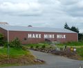
Mildly amusing barn wall, about a kilometer from the hashpoint
