Difference between revisions of "2012-08-18 41 -88"
From Geohashing
imported>EvilUncleNomo ([live picture] Long walk from target to car (NOT!) [http://www.openstreetmap.org/?lat=41.56675742&lon=-88.15388338&zoom=16&layers=B000FTF @41.5668,-88.1539]) |
imported>EvilUncleNomo |
||
| Line 16: | Line 16: | ||
== Expedition == | == Expedition == | ||
| − | + | This was an unexpectedly easy geohash. We drove south for 20 minutes to a residential neighborhood in Crystal Lawns, parked the car by the side of the road and walked 10 feet to our target. I'm not sure why, but there was a small field of soybeans next to the target. | |
| − | |||
| − | |||
| − | |||
== Photos == | == Photos == | ||
| − | |||
| − | |||
| − | |||
<gallery perrow="5"> | <gallery perrow="5"> | ||
| − | Image:2012-08-18_41_-88_16-23-17-830.jpg | No geohash boots required | + | Image:2012-08-18_41_-88_16-23-17-830.jpg | No geohash boots required |
| − | Image:2012-08-18_41_-88_16-23-56-811.jpg | Evil Uncle Nomo | + | Image:2012-08-18_41_-88_16-23-56-811.jpg | Evil Uncle Nomo |
| − | Image:2012-08-18_41_-88_16-24-32-350.jpg | The Wife | + | Image:2012-08-18_41_-88_16-24-32-350.jpg | The Wife |
| − | Image:2012-08-18_41_-88_16-24-59-073.jpg | Soybeans | + | Image:2012-08-18_41_-88_16-24-59-073.jpg | Soybeans |
| − | Image:2012-08-18_41_-88_16-26-44-504.jpg | Long walk from target to car (NOT!) | + | Image:2012-08-18_41_-88_16-26-44-504.jpg | Long walk from target to car (NOT!) |
</gallery> | </gallery> | ||
| − | |||
| − | |||
| − | |||
| − | |||
| − | |||
| − | |||
| − | |||
| − | |||
| − | |||
[[Category:Expeditions]] | [[Category:Expeditions]] | ||
| − | |||
[[Category:Expeditions with photos]] | [[Category:Expeditions with photos]] | ||
| − | |||
| − | |||
| − | |||
| − | |||
| − | |||
[[Category:Coordinates reached]] | [[Category:Coordinates reached]] | ||
| − | |||
| − | |||
| − | |||
| − | |||
| − | |||
| − | |||
| − | |||
| − | |||
| − | |||
| − | |||
| − | |||
| − | |||
| − | |||
| − | |||
| − | |||
| − | |||
| − | |||
| − | |||
Revision as of 19:08, 19 August 2012
| Sat 18 Aug 2012 in 41,-88: 41.5667700, -88.1539128 geohashing.info google osm bing/os kml crox |
Location
In a residential neighborhood in Crystal Lawns, Illinois, U.S.A.
Participants
Plans
- EvilUncleNomo and The Wife are planning on attempting this geohash at Saturday afternoon at 4:00 p.m.. We haven't done any 'hashing in a while, so I hope we remember how. (Now, where'd I put my geohash boots?)
Expedition
This was an unexpectedly easy geohash. We drove south for 20 minutes to a residential neighborhood in Crystal Lawns, parked the car by the side of the road and walked 10 feet to our target. I'm not sure why, but there was a small field of soybeans next to the target.
Photos
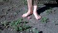
No geohash boots required
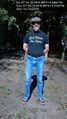
Evil Uncle Nomo

The Wife
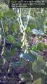
Soybeans
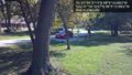
Long walk from target to car (NOT!)


