Difference between revisions of "2012-12-09 51 0"
imported>The T-Man m (Cleaned up) |
imported>Huinesoron (Photos; report later.) |
||
| Line 18: | Line 18: | ||
== Expedition == | == Expedition == | ||
Reached! No hash collision possible, sadly. Full report when I get one written. | Reached! No hash collision possible, sadly. Full report when I get one written. | ||
| + | |||
| + | == Photos == | ||
| + | |||
| + | <gallery perrow="5"> | ||
| + | Image:2012-12-09 51 -0 Multihashcollision.jpg | Look how close they are! | ||
| + | Image:2012-12-09 51 0 LooksMessy.jpg | The second (and last) hash on my tour. | ||
| + | Image:2012-12-09 51 0 LongWalkToHash.jpg | Nearby parking is too much to ask, huh? | ||
| + | Image:2012-12-09 51 0 YayAFootpath.jpg | A footpath! That's legal access! | ||
| + | Image:2012-12-09 51 0 ThatsAPathRight.jpg | That... ''is'' a footpath, right? | ||
| + | Image:2012-12-09 51 0 OutThere.jpg | The hashpoint is out there in a sea of mud. | ||
| + | Image:2012-12-09 51 0 StupidGrinInStupidField.jpg | As, a minute later, was I! | ||
| + | Image:2012-12-09 51 0 HelpfulSign.jpg | Surely this sign will last for generations. | ||
| + | Image:2012-12-09 51 0 FeetOfClay.jpg | Is there an achievement for ruining your shoes? | ||
| + | </gallery> | ||
| + | |||
| + | |||
| + | |||
| + | |||
| + | |||
[[Category:Expeditions]] | [[Category:Expeditions]] | ||
[[Category:Coordinates reached]] | [[Category:Coordinates reached]] | ||
Revision as of 06:55, 12 August 2015
| Sun 9 Dec 2012 in 51,0: 51.1711597, 0.0247772 geohashing.info google osm bing/os kml crox |
Location
A field just east of Lingfield, Surrey - and within three miles of the neighbouring graticule's hashpoint. Gotta love that Prime Meridian!
Participants
Plans
Huinesoron intends to head down sometime Sunday afternoon and hit (or at least stare longingly at) both this and the 51 -0 hashpoint for a Multihash.
For this one in particular, there's also a number of geocaches that, given the wintery trees, may be within sight of the hashpoint, making for a possible hash collision achievement.
Expedition
Reached! No hash collision possible, sadly. Full report when I get one written.
Photos
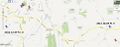
Look how close they are!
The second (and last) hash on my tour.
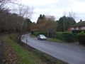
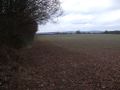
Nearby parking is too much to ask, huh?
A footpath! That's legal access!
That... is a footpath, right?
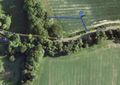
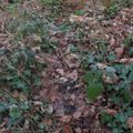
The hashpoint is out there in a sea of mud.

As, a minute later, was I!
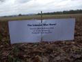
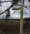
Surely this sign will last for generations.
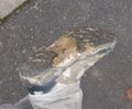
Is there an achievement for ruining your shoes?


