Difference between revisions of "2013-06-01 52 -1"
imported>Nickholden (Created page with "{{meetup graticule | lat=52 | lon=-1 | date=2013-06-01 | graticule_name=Birmingham | graticule_link=Birmingham, United Kingdom }} __NOTOC__ == Location == A small patch of g...") |
imported>Nickholden |
||
| Line 16: | Line 16: | ||
== Plans == | == Plans == | ||
Aiming for a 4pm meetup. | Aiming for a 4pm meetup. | ||
| + | |||
| + | == Expedition == | ||
| + | <!-- how it all turned out. your narrative goes here. --> | ||
| + | Disturbingly easy. Ride in to Leicester via the Great Central Way (lots of people because the Riverside Festival was in full swing in Bede Park), cut across to the geohash point for cucumber sandwiches and then rode home 'the long way' (i.e. by going in the opposite direction for ten kilometres and then heading out into the countryside before a stop for a cup of tea. | ||
| + | |||
| + | == Tracklog == | ||
| + | <!-- if your GPS device keeps a log, you may post a link here --> | ||
| + | |||
| + | On Strava: http://app.strava.com/activities/57544146 | ||
| + | |||
| + | == Photos == | ||
| + | <!-- Insert pictures between the gallery tags using the following format: | ||
| + | Image:2012-##-## ## ## Alpha.jpg | Witty Comment | ||
| + | --> | ||
| + | <gallery perrow="5"> | ||
| + | Image:2013_06_01_geohash_poster_52_-1.jpg | The internet was here... | ||
| + | Image:Screenshot_2013-06-01-16-10-43.png | See? | ||
| + | </gallery> | ||
| + | |||
| + | == Achievements == | ||
| + | {{#vardefine:ribbonwidth|800px}} | ||
| + | <!-- Add any achievement ribbons you earned below, or remove this section --> | ||
| + | |||
| + | Nearly qualified for the Tron achievement. But went up the old GCW segment leading to the Bowstring Bridge, forgetting it had been knocked down four years ago, so had to turn round and go the 'new' way. Oops. | ||
== Other geohashing expeditions on the same day == | == Other geohashing expeditions on the same day == | ||
| Line 22: | Line 46: | ||
| − | [[Category: | + | [[Category:Expeditions]] |
| + | [[Category:Expeditions with photos]] | ||
| + | [[Category:Coordinates reached]] | ||
Revision as of 08:26, 2 June 2013
| Sat 1 Jun 2013 in Birmingham: 52.6477531, -1.1495333 geohashing.info google osm bing/os kml crox |
Location
A small patch of grass by Anstey Lane in Leicester. Shall we have an urban picnic?
Participants
Plans
Aiming for a 4pm meetup.
Expedition
Disturbingly easy. Ride in to Leicester via the Great Central Way (lots of people because the Riverside Festival was in full swing in Bede Park), cut across to the geohash point for cucumber sandwiches and then rode home 'the long way' (i.e. by going in the opposite direction for ten kilometres and then heading out into the countryside before a stop for a cup of tea.
Tracklog
On Strava: http://app.strava.com/activities/57544146
Photos

The internet was here...
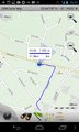
See?


Achievements
Nearly qualified for the Tron achievement. But went up the old GCW segment leading to the Bowstring Bridge, forgetting it had been knocked down four years ago, so had to turn round and go the 'new' way. Oops.
Other geohashing expeditions on the same day
Expeditions and Plans
| 2013-06-01 | ||
|---|---|---|
| San Diego, California | JesseW, LucasBrown | Right on the Silver Strand beach |
| Baltimore, Maryland | OfficeLinebacker, Allison | Along some railroad tracks in Port Deposit, MD |
| Cincinnati, Ohio | M5rammy, Nom de Hash, Christine, Lisa | The theater was closed and the parking lot was locked, but we used our ninj... |
| Lima, Ohio | Someone went | located in Cridersville. |
| McMinnville, Oregon | Jim | Ag Land west of North Plains |
| Seattle, Washington | OtherJack | Someone's front lawn in north Bellevue near Microsoft, but ended up in Seat... |
| Birmingham, United Kingdom | Nick Holden | A small patch of grass by Anstey Lane in Leicester. Shall we have an urban ... |
| Hannover, Germany | Oliver | On a field near Nienburg/Weser. |