Difference between revisions of "2013-08-01 49 11"
imported>Paintedhell |
imported>Paintedhell |
||
| Line 15: | Line 15: | ||
== Expedition == | == Expedition == | ||
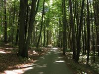
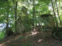
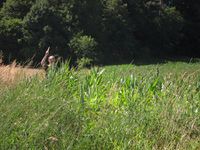
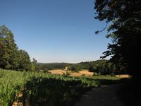
The Ninja and me were on our way to holiday, we had lots of time, the Ninja was adventurous and so we took the chance to conquer 49/11 by stopping and going Geohashing! Once again this was difficulty level 2: instead of following a working GPS with a map or at least a proper paper map without GPS, my GPS was already prepared for the week abroad and I had deleted the German OSM the day before, of course we had no paper map of the area and the navigation system of our car was also practically useless for the purpose. Using a combination of the direction line on my GPS and the useless car navi, we parked at 2.6km distance to the point (as the bird flies) and hiked off in the blue (which was more green really). Everything went perfect for one kilometer, we found some nice rocks to climb on but after that the way took a turn in the wrong direction, so we had to go offroad, and after a little cross-country-stumbling we found another way that took us some hundred meters near the point. The last bit was stumbling again, but not really bad and we also found the point. The way back was even easier, we decided to try a little detour which was really clever because we found an almost perfect way back to our car. | The Ninja and me were on our way to holiday, we had lots of time, the Ninja was adventurous and so we took the chance to conquer 49/11 by stopping and going Geohashing! Once again this was difficulty level 2: instead of following a working GPS with a map or at least a proper paper map without GPS, my GPS was already prepared for the week abroad and I had deleted the German OSM the day before, of course we had no paper map of the area and the navigation system of our car was also practically useless for the purpose. Using a combination of the direction line on my GPS and the useless car navi, we parked at 2.6km distance to the point (as the bird flies) and hiked off in the blue (which was more green really). Everything went perfect for one kilometer, we found some nice rocks to climb on but after that the way took a turn in the wrong direction, so we had to go offroad, and after a little cross-country-stumbling we found another way that took us some hundred meters near the point. The last bit was stumbling again, but not really bad and we also found the point. The way back was even easier, we decided to try a little detour which was really clever because we found an almost perfect way back to our car. | ||
| + | |||
| + | {{Minesweeper geohash | graticule = Erfurt, Germany | ranknumber = 5 | n = true | ne = true | w = true | e = true | s = true | name = Juja}} | ||
== Photos == | == Photos == | ||
Revision as of 18:09, 11 August 2013
| Thu 1 Aug 2013 in 49,11: 49.5702999, 11.4590102 geohashing.info google osm bing/os kml crox |
Location
Somewhere that's green, near the village of Stöppach.
Participants
- Juja and her personal Ninja
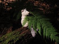
- Benjy and Frankie Mouse
Expedition
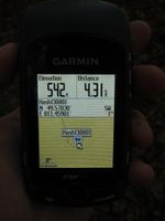
The Ninja and me were on our way to holiday, we had lots of time, the Ninja was adventurous and so we took the chance to conquer 49/11 by stopping and going Geohashing! Once again this was difficulty level 2: instead of following a working GPS with a map or at least a proper paper map without GPS, my GPS was already prepared for the week abroad and I had deleted the German OSM the day before, of course we had no paper map of the area and the navigation system of our car was also practically useless for the purpose. Using a combination of the direction line on my GPS and the useless car navi, we parked at 2.6km distance to the point (as the bird flies) and hiked off in the blue (which was more green really). Everything went perfect for one kilometer, we found some nice rocks to climb on but after that the way took a turn in the wrong direction, so we had to go offroad, and after a little cross-country-stumbling we found another way that took us some hundred meters near the point. The last bit was stumbling again, but not really bad and we also found the point. The way back was even easier, we decided to try a little detour which was really clever because we found an almost perfect way back to our car.
Juja achieved level 5 of the Minesweeper Geohash achievement
|
Photos
|
